Located in the Benasque valley in the Aragonese region of Ribagorza in the heart of the Posets-Maladeta Natural Park,
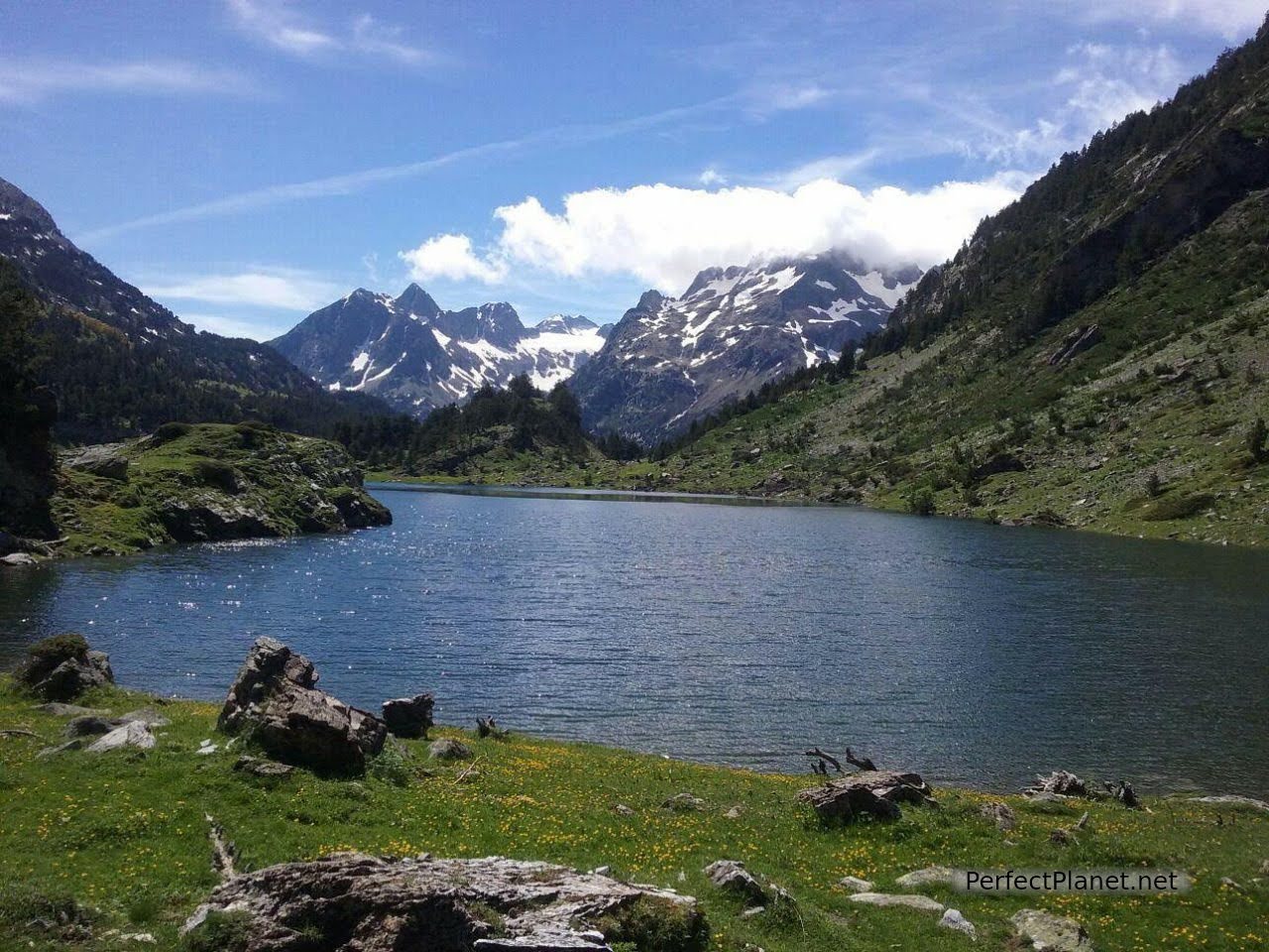
Plan del Estañ
the Aneto peak is one of the most accessible and sought-after peaks for lovers of high mountains.
With its 3,404 metres it is the highest peak in the Pyrenees and the second highest in the Iberian Peninsula.
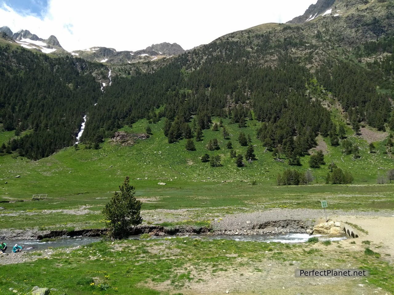
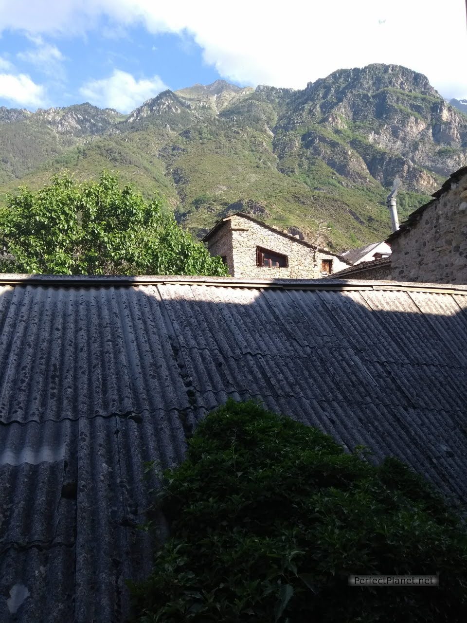
We start our route from Llanos del Hospital, where we leave the car, some thirteen kilometres from the beautiful town of Benasque.
From Llanos del Hospital we start our route that will take us to the Renclusa refuge, where we will spend the night.
Llanos del Hospital
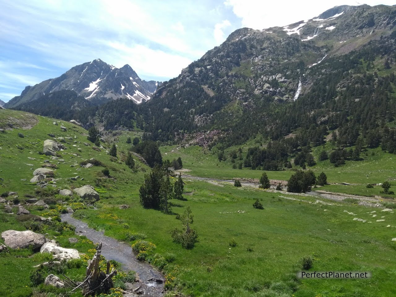
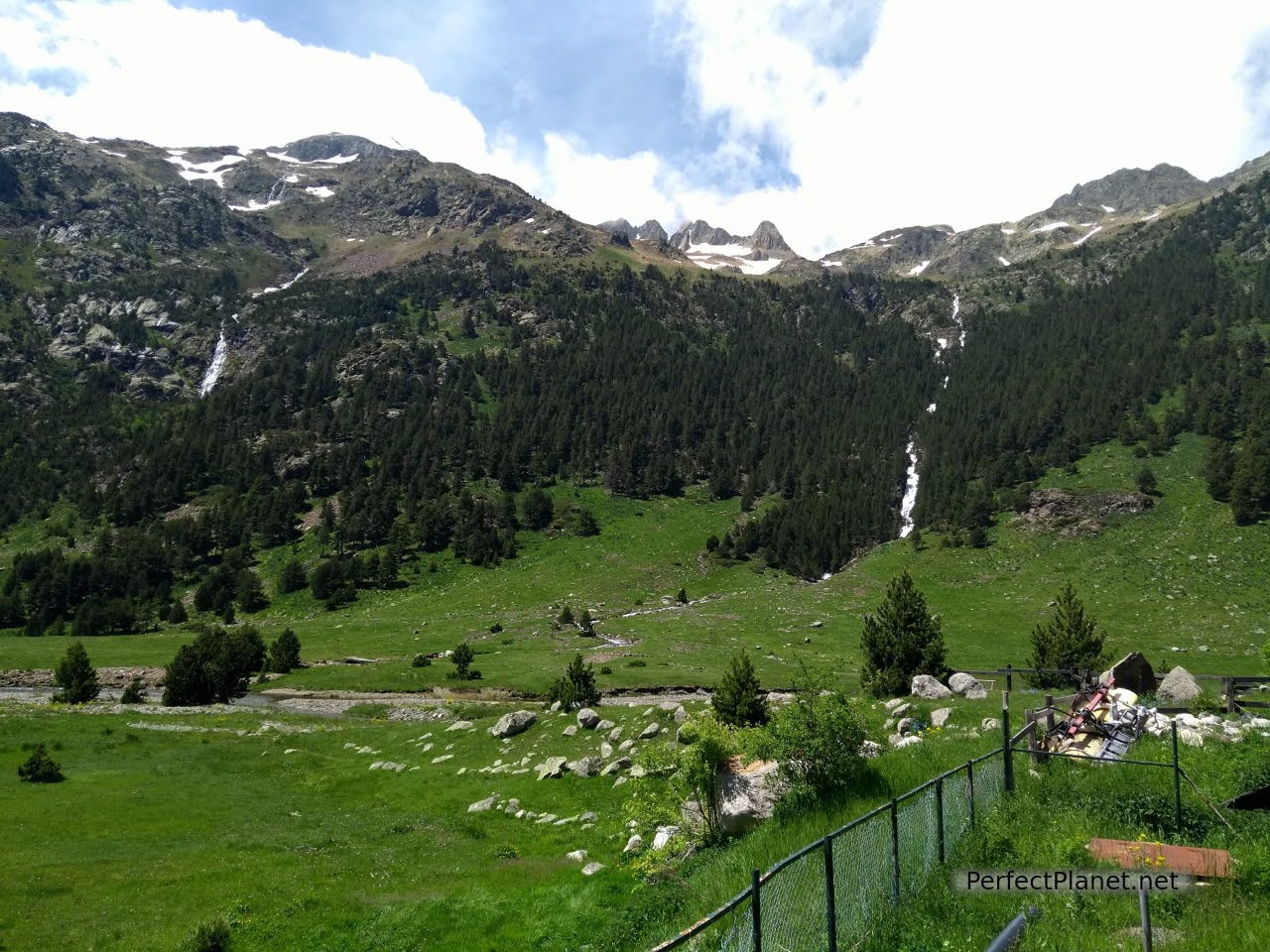
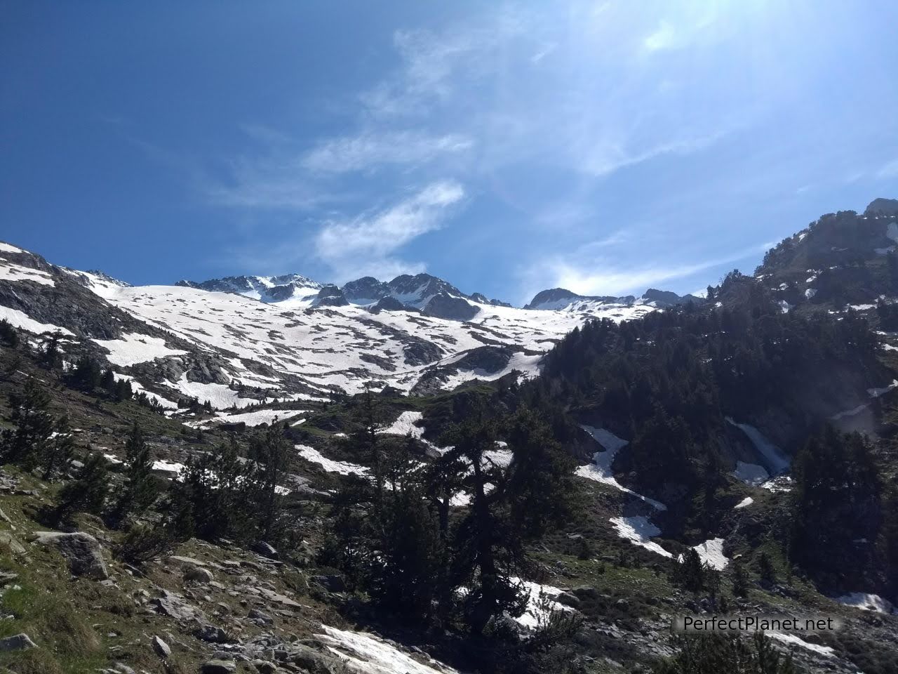
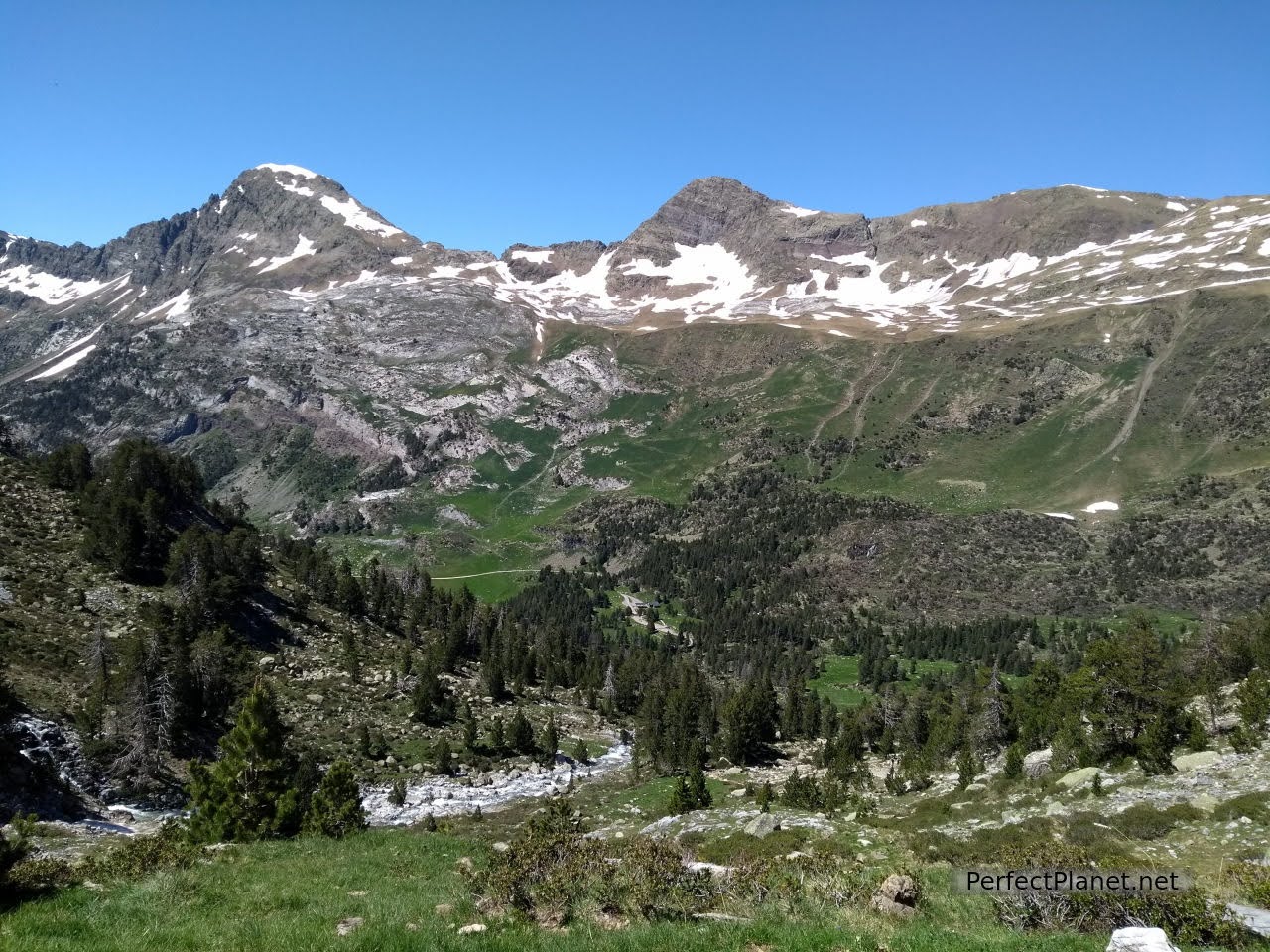
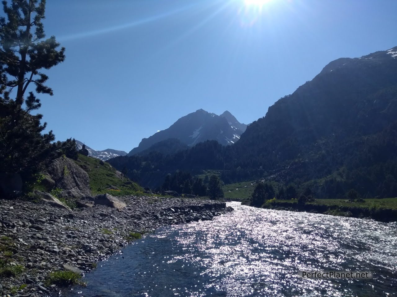
Many people leave the car at the Besurta and continue along the Besurta path from Llanos del Hospital, saving almost four kilometres of walking, but the river has overflowed its banks and the path is cut off. So we take our rucksacks and walk along the path behind the car park parallel to the river Esera, first through a meadow from Plan del Hospital and then through the forest, enjoying beautiful spots such as Plan d'l Estañ and Plan de la Besurta until we reach the crossroads from where we take the path on the right that leads us through the Renclusa ravine to the Renclusa refuge.
Llanos del Hospital
It is June and it is extremely hot despite the fact that there is plenty of snow all around the refuge. It is a good time to climb the north face of the Aneto, there are not too many people and the snow conditions are good, although you have to get up early enough so that the snow is not too soft when you return.
La Renclusa gorge
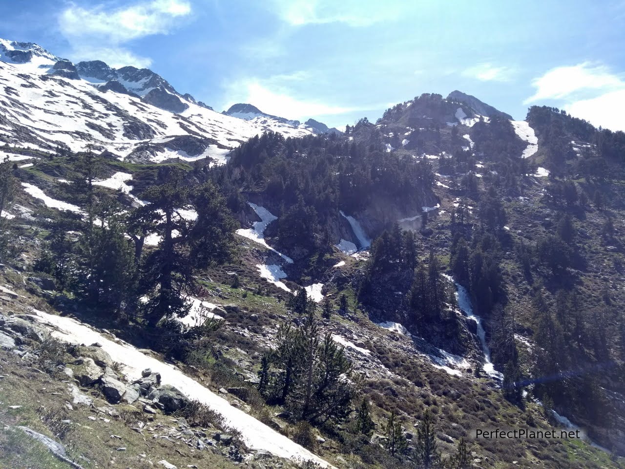
La Renclusa gorge
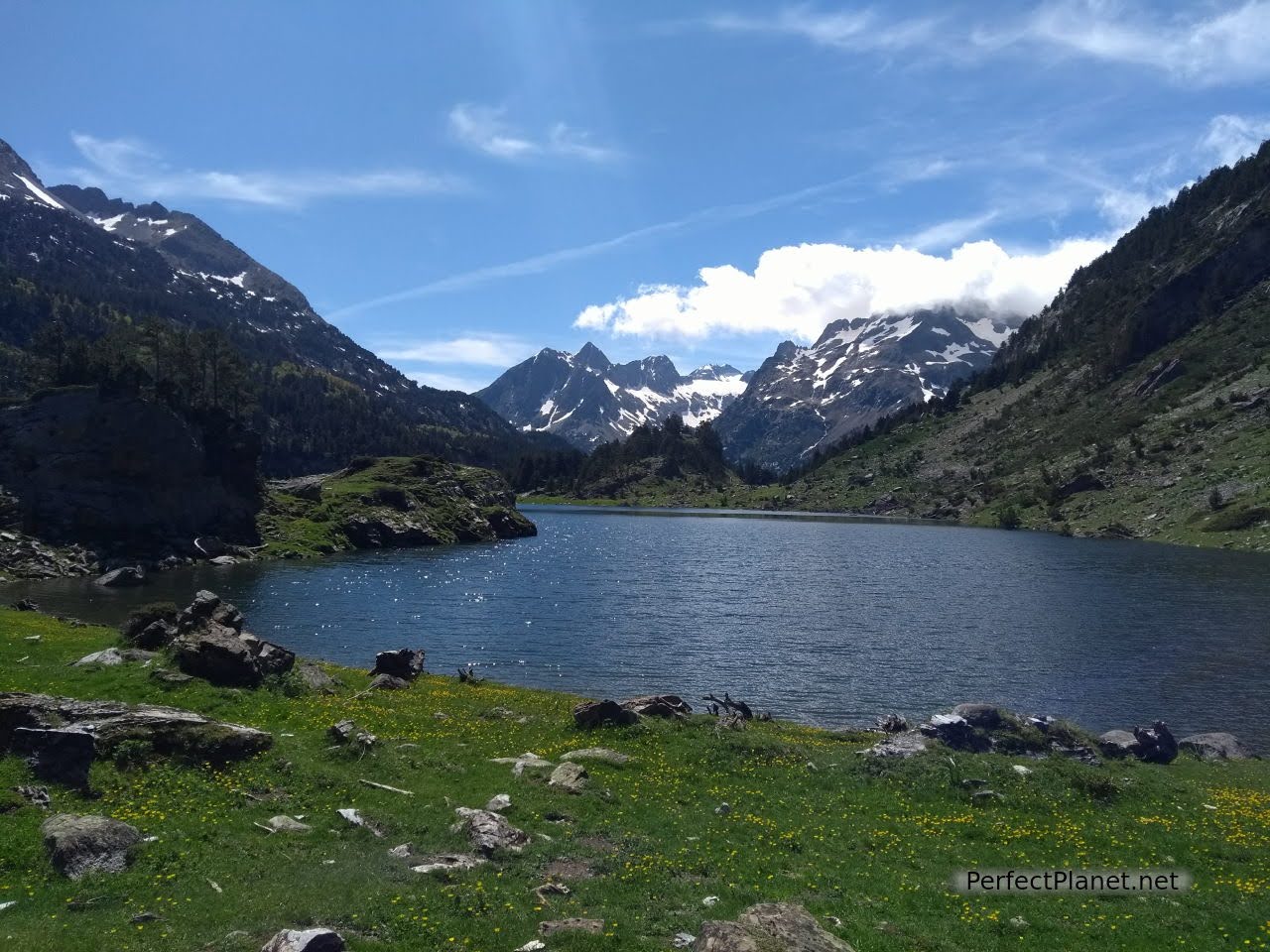
The views from the refuge are beautiful. We rested on some rocks watching the lucky ones who had climbed this morning come down.
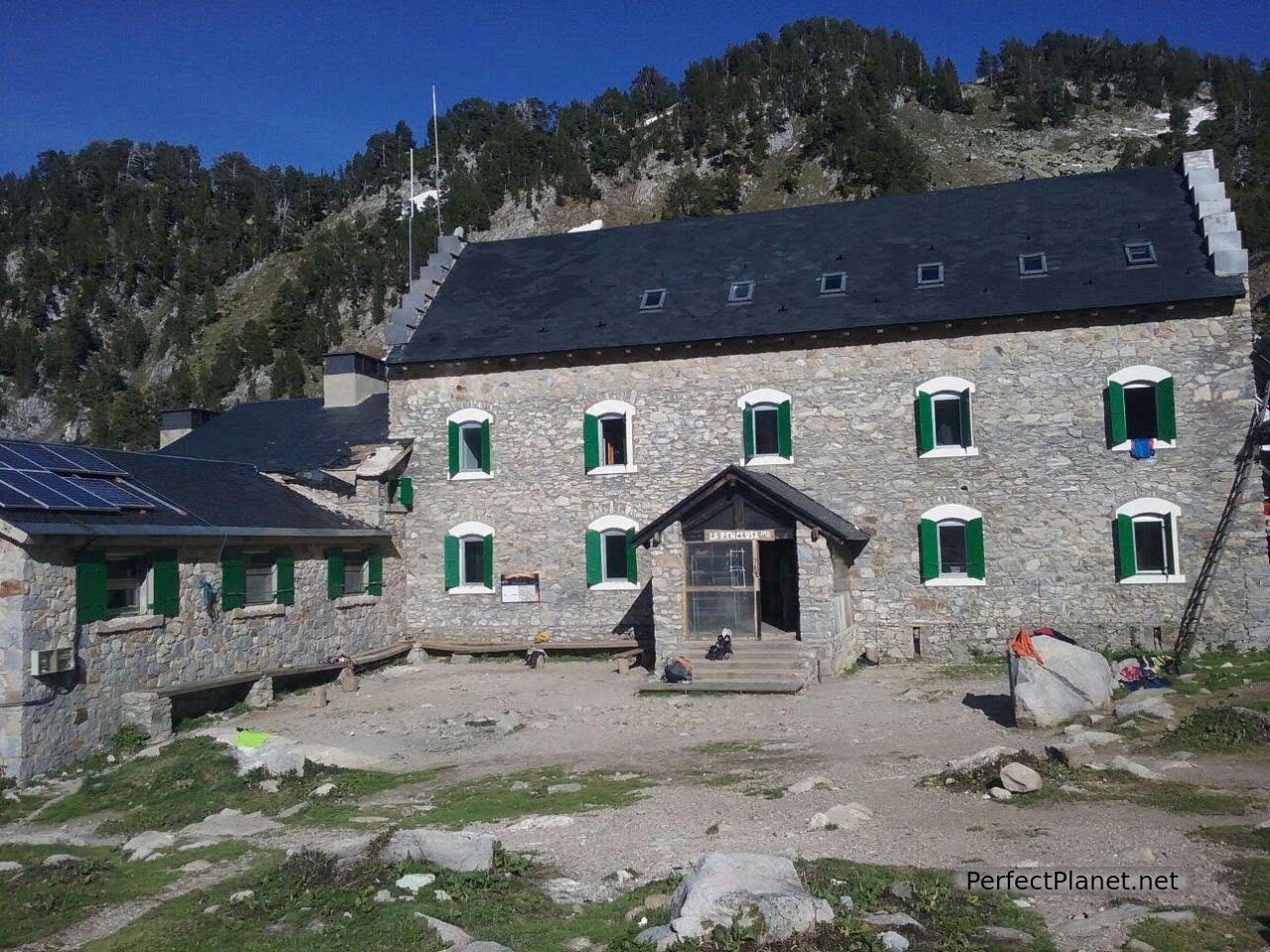
La Renclusa refuge is very good, it has a capacity of 92 people and is open all year round. But we advise you to book. The rooms are shared and mixed, so remember to bring earplugs if you want to get some rest. Backpacks and equipment are left in lockers in the lower part of the refuge and there are rest shoes. There is a kitchen, bar, showers and heating.
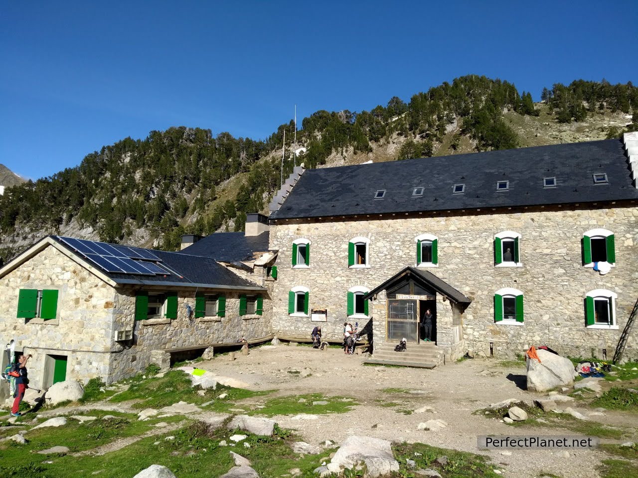
La Renclusa refuge
It is advisable to sleep in the refuge to get used to the altitude and avoid the dreaded altitude sickness.
Before organising any mountain outing, apart from taking the right equipment, check the weather pages to see the weather, wind speed and snow conditions. We use AEMET and Meteoexploration, which give a fairly reliable forecast, although the latter only for the main peaks. If you don't have a GPS like Garmin, the Wikiloc app is very useful, where you can download, record and follow the tracks of the routes you are going to do.
Dawning
Near the refuge there are two webcams where you can see the state of the mountain.
Equipment needed: crampons, ice axe and helmet all year round, as there is a permanent glacier before the summit. You should also bring a headlamp, water, GPS, extra battery, sleeping bag, warm clothes, first aid kit and sun cream. It is advisable to bring a rope, but not essential. Many people climb with skis.
Up to the Portillon
We want to do a circular route up to the peak but the refuge tells us that there is too much snow and it is not advisable. It is very important to check your plans with the people who run the refuges; they are usually experienced guides and know the area better than anyone else.
It is not necessary to hire a guide to make the ascent, the path is well marked and there are so many people that the trail is very visible. However, if you wish to do so, contact the refuge or the Aragonese Mountaineering Federation beforehand.
We have dinner and go to bed early, tomorrow is going to be a very exciting day.
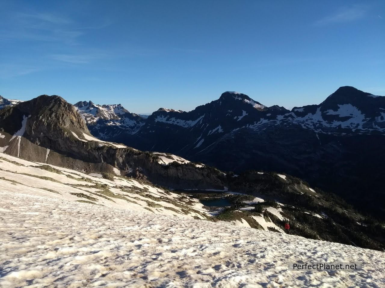
Views
We get up at 6 am. I didn't sleep at all because despite wearing earplugs my bunkmate was snoring like a platypus, anyway....
After breakfast, we left the non-essential stuff in the locker and set off. A thrilling silence envelops us.
Views
The weather forecast is very good, no gusts of wind at the top and sunny.
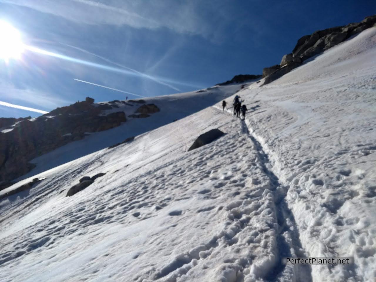
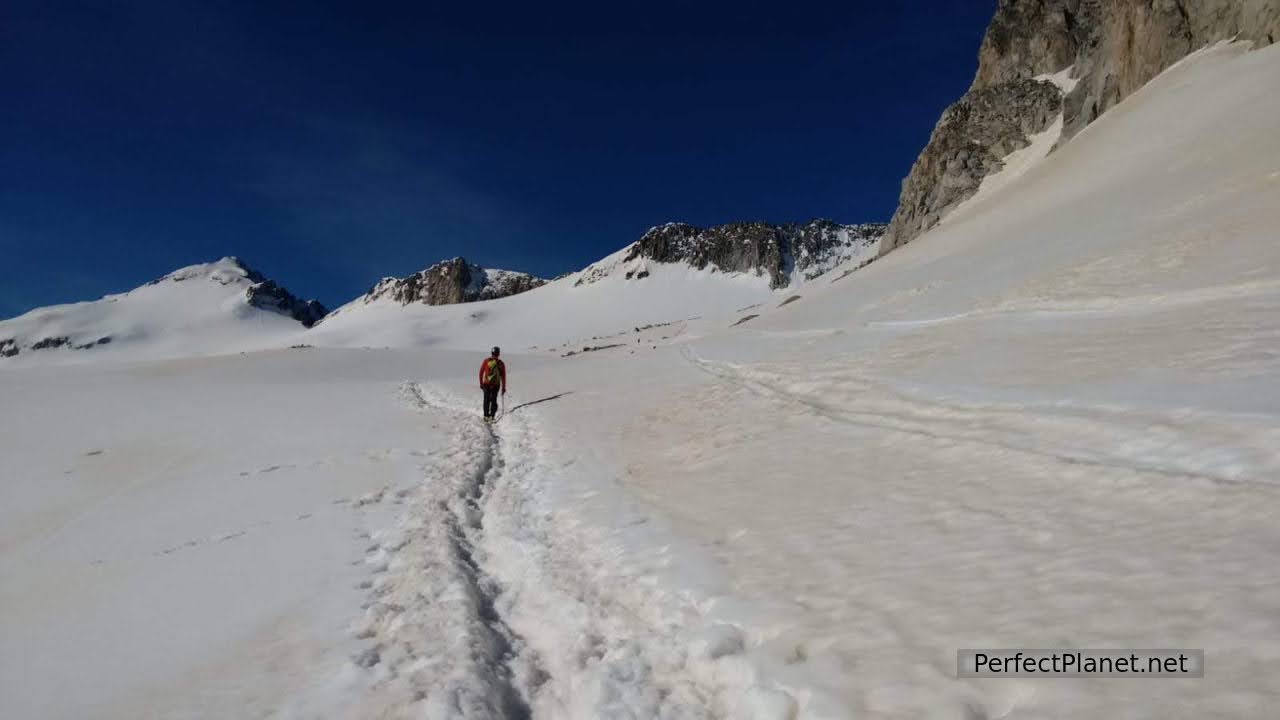
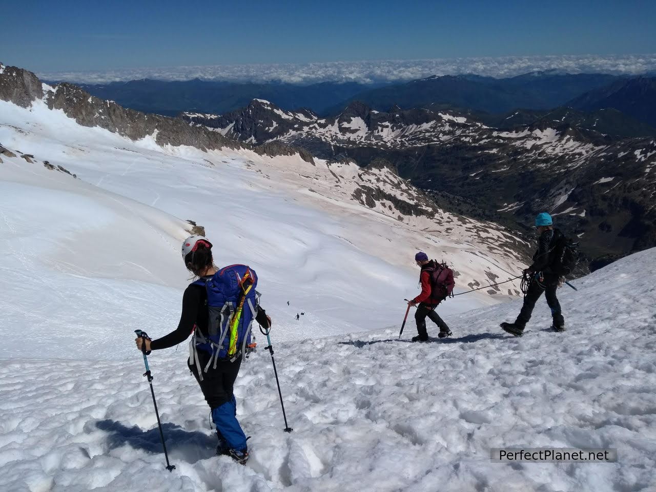
The first stretch up to the Portillon Superior is quite steep and icy, so after a couple of hundred metres we put on our crampons.
Past the Portillon
The Portillon Superior is an area of some complexity, depending on the state of the snow or ice, but we overcome it without difficulty. We can already see the distant summit. Impressive.
Maladetas
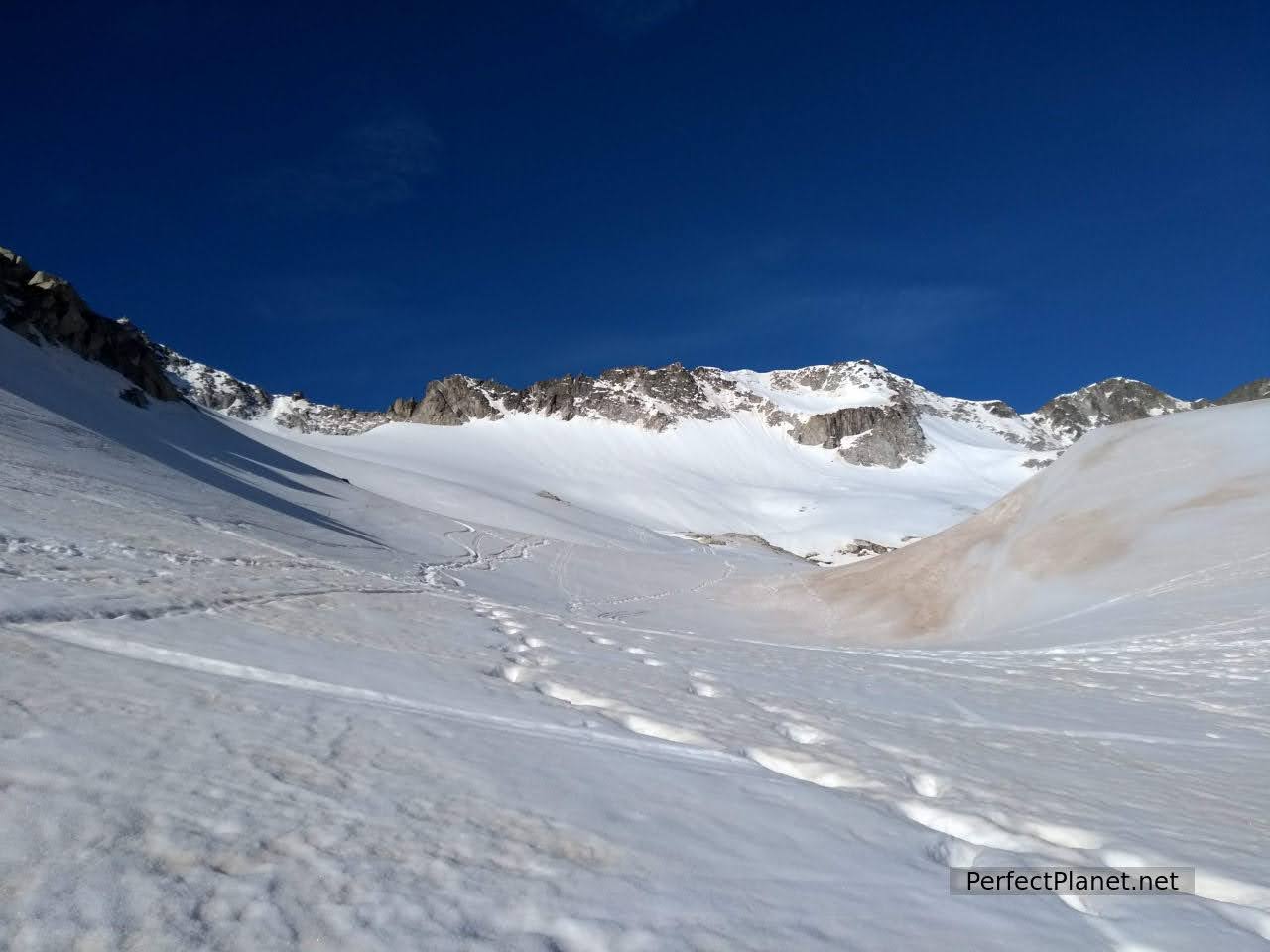
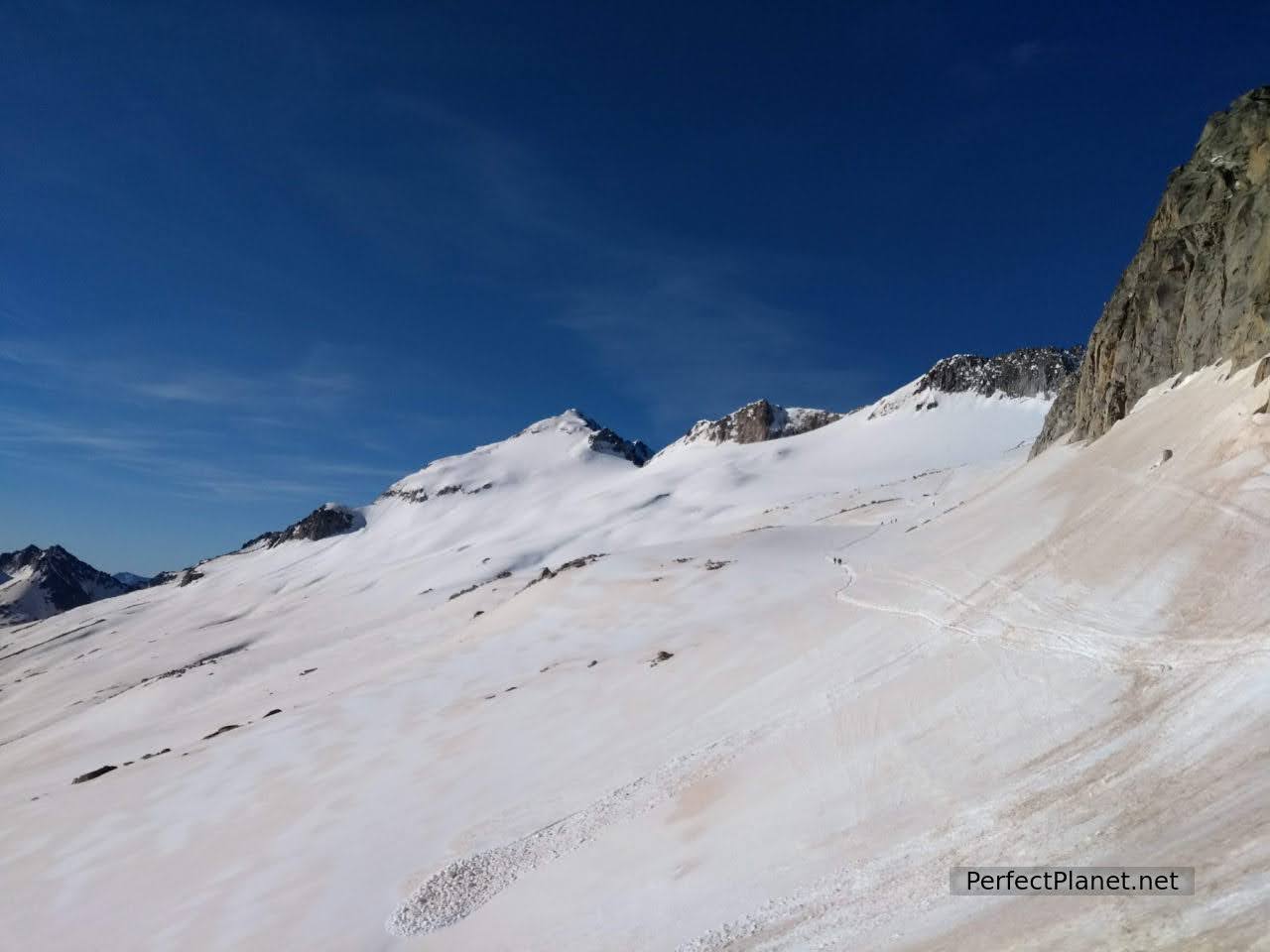
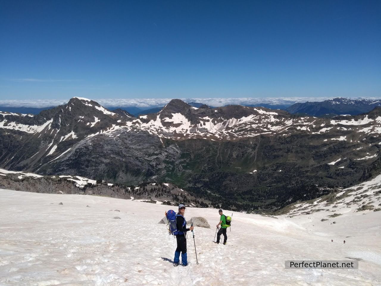
We continue until we reach the glacier which we cross easily, to our left the Maladetas massif. Spectacular.
Glacier
Glacier
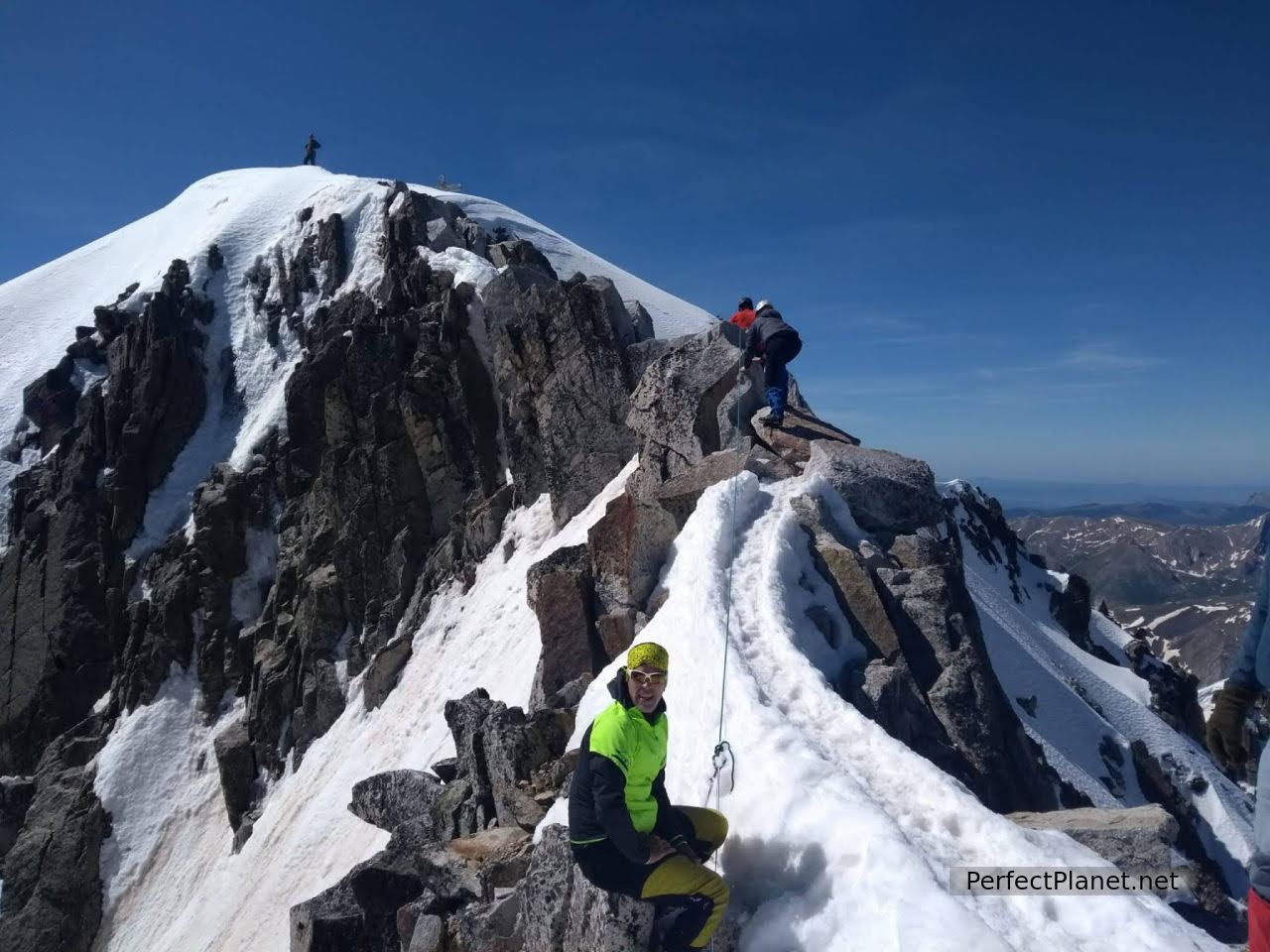
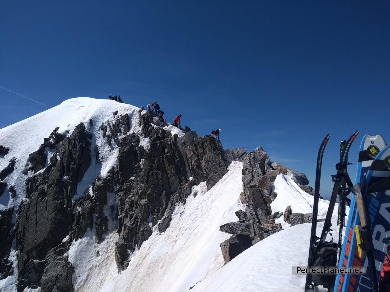
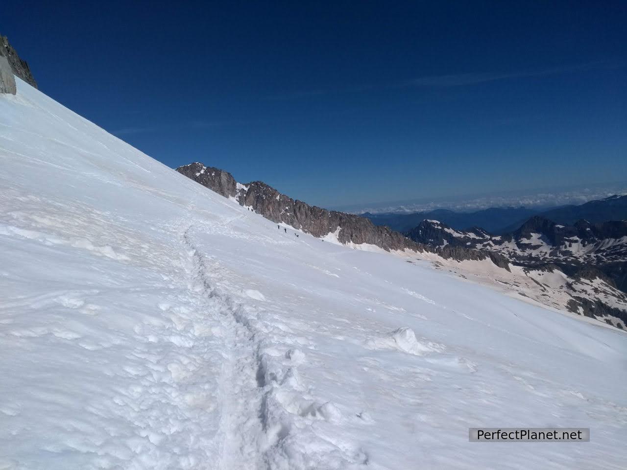
We arrive at the pass of Coronas, the last and hard ascent begins until we reach the famous Paso de Mahoma.
Pass of Coronas
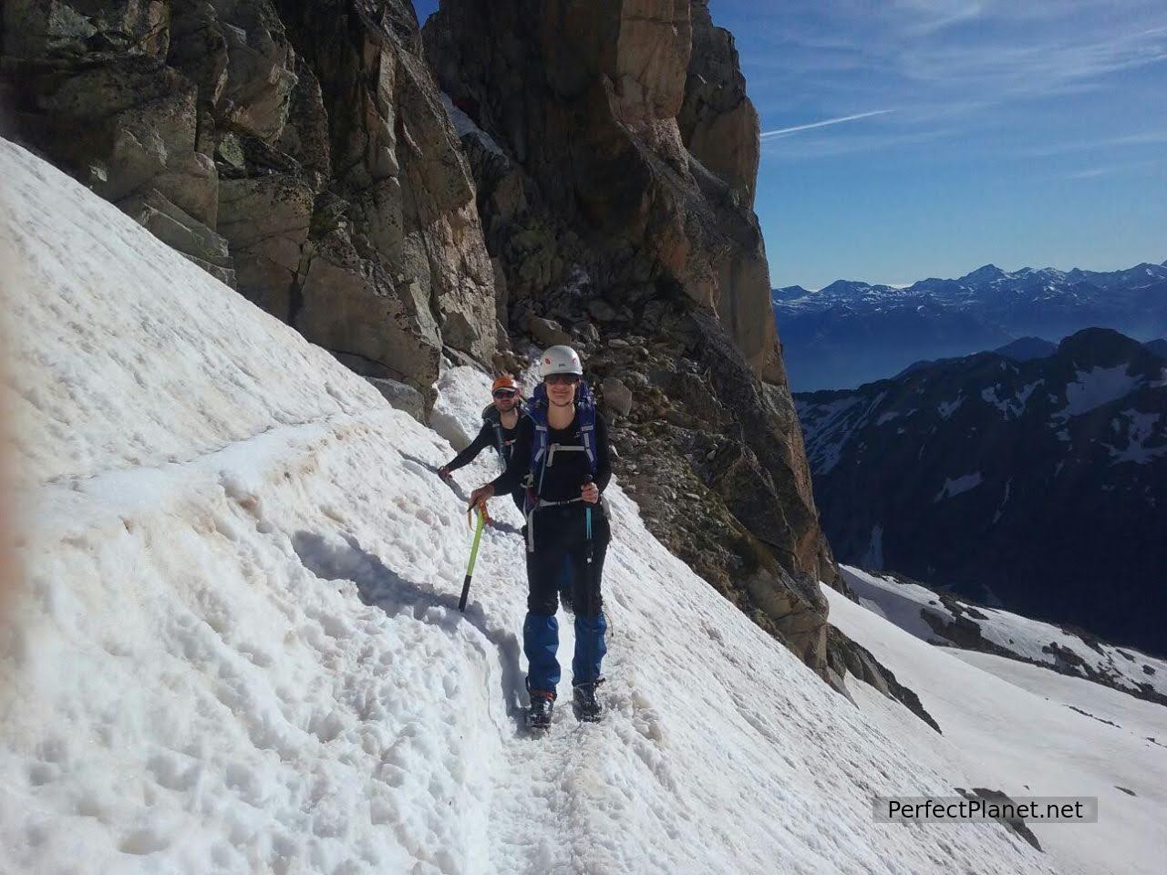
The Paso de Mahoma is a very exposed ridge on both sides. We leave our rucksacks behind and carefully climb up to the Aneto Cross. Impressive views and place. I have no words to describe it.
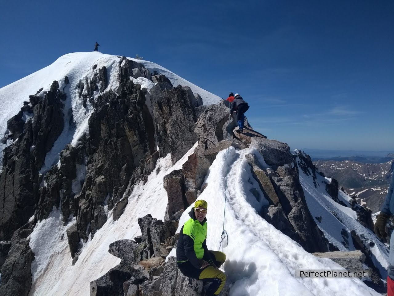
Passage of Mahoma

Passage of Mahoma
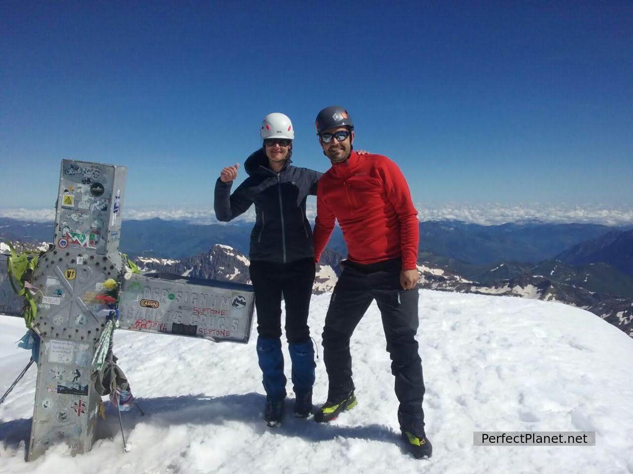
Aneto Cross
We have to be careful because the pass has a lot of snow. A group arrives to the Mahoma Pass, one of them is 82 years old and they are celebrating it by climbing the highest peak in the Pyrenees.
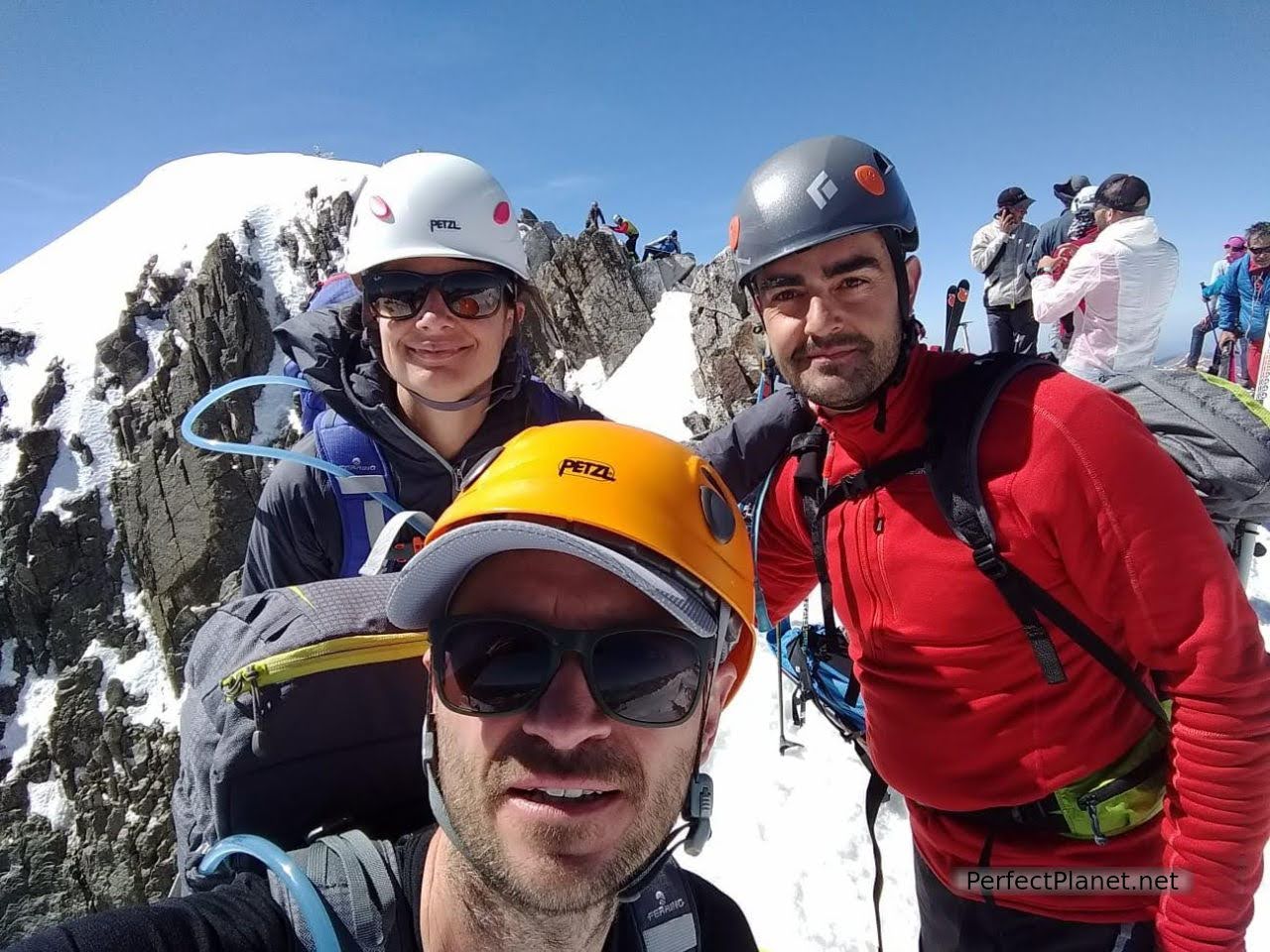
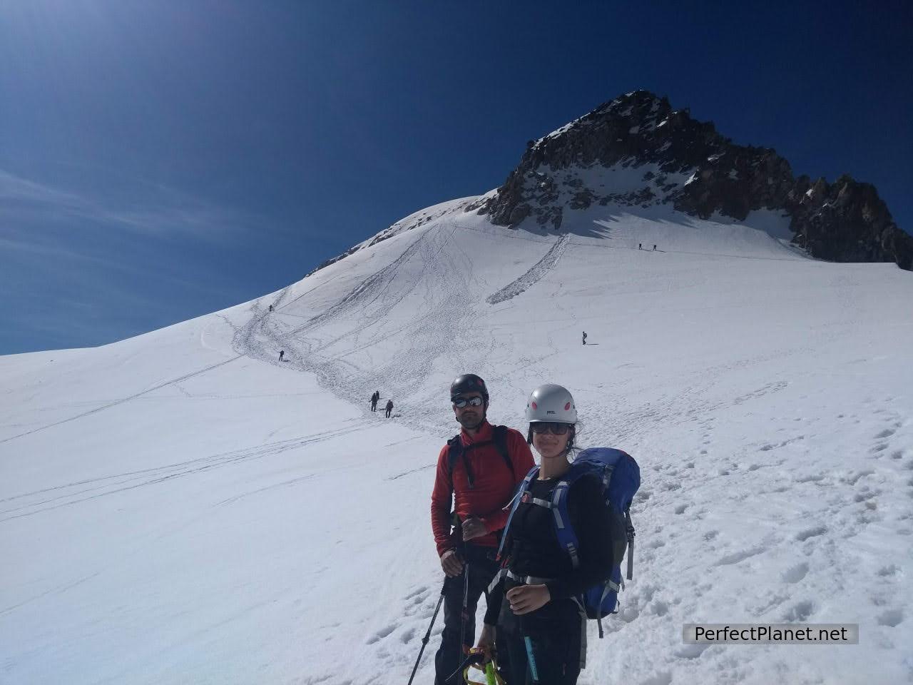
Us
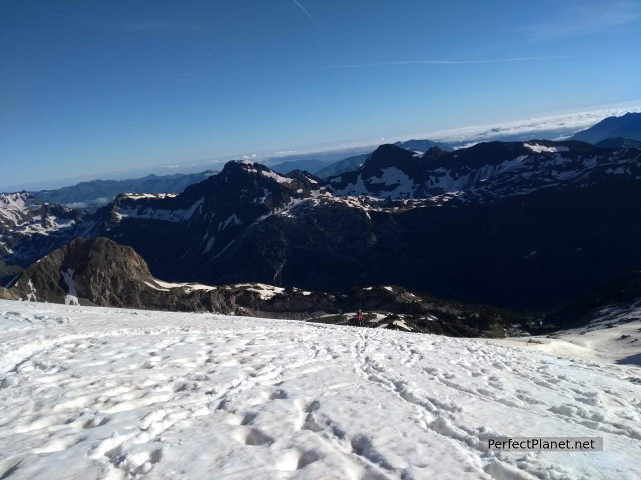
We return by the same route as we have been advised at the refuge. The return is difficult in some sections as the temperature is rising and the snow is melting, at times we sink up to our groin.
We are overtaken by the 82 year old man, an expert mountaineer who skis down at a devilish speed.
The worst section is near the Portillon Superior, as large holes have formed due to the melting snow.
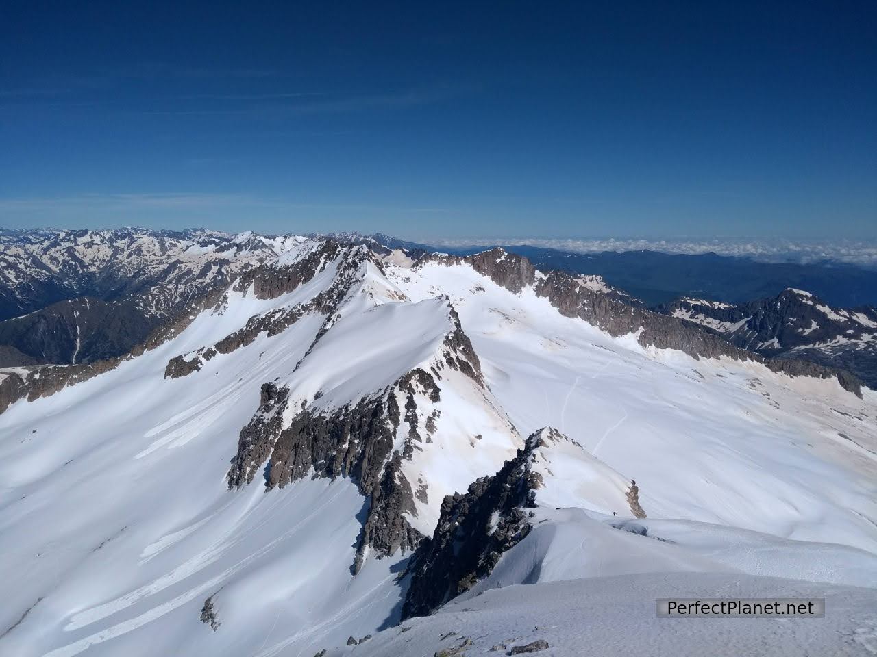
Maladetas
Back to refuge
We meet a man who is looking for his guide, he has lost his way and has run out of water. A while later the French guide appears, looking for his client. What a pair of them.
After the Portillon, the only thing left to do is to get to the Renclusa refuge and stop for lunch.
Back to refuge
It is quite a demanding route and you have to be in good physical shape.
We eat at the refuge, pick up our things from the lockers and return to Llanos del Hospital. The last kilometre takes forever.
A fantastic day in an impressive place that we will never forget.
Meadow
We stayed in Benasque at the Apartamentos Petronilla, very well located in the centre of Benasque, easy parking and access to supermarkets and restaurants.
Benasque is a beautiful town to visit at any time of the year. It serves as a base camp for any activity in the area due to its location. It combines more traditional architecture with more modern architecture but retains the rural charm that we love so much.
Llanos del Hospital
You can see traditional architecture in the Palace of the Counts of Ribagorza or Casa Juste with its characteristic Tower.
Views from the apartment
Other interesting nearby towns are Anciles and Cerler.
Accommodation: La Renclusa refuge, half board 35€/pax half board for members of the federation, including dinner and breakfast. For more information see the website.
Route: circular
Distance: 22 kilometres.
Difference in altitude: 1,800 metres
Tips: we start the route from Llanos del Hospital as it is not possible to reach the Besurta by car, if you can park in the Besurta you will save some kilometres. Wikiloc track.
Difficulty: high, no technical difficulty.
Signposting: good.
Whoever uses and follows all or part of this track and its additional information, assumes full responsibility for the risks inherent to the practice of the activity, this information is for guidance purposes only.
- Log in to post comments