
Maciéndome peak, circular route between the Natural Park of Redes and the Natural Park of Ponga.
Summit
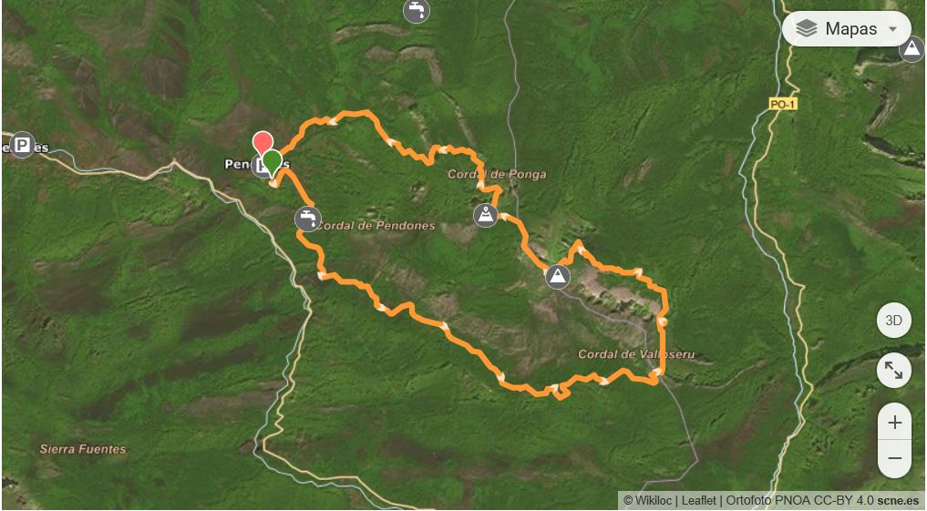
Circular route from the Asturian town of Pendones through the Vega Baxu, Cordal de Valloseru valley Ambenes, Mayá Maciédome, Pico Maciédome, Maya Llagu, Foz del Congostín and return to Pendones. We walk through the Redes Park again with our friends Manolo and Pepe, accompanied by more friends.
On route
We leave Pendones early in the morning to take the track that leaves from the other side of the car park, crossing the river towards the Gargasa spring. We walk through woods and meadows until we reach the Vega Baxu where we find some cattle sheds.
From here the path gets narrower and narrower until you reach the river where you can enjoy a beautiful waterfall.
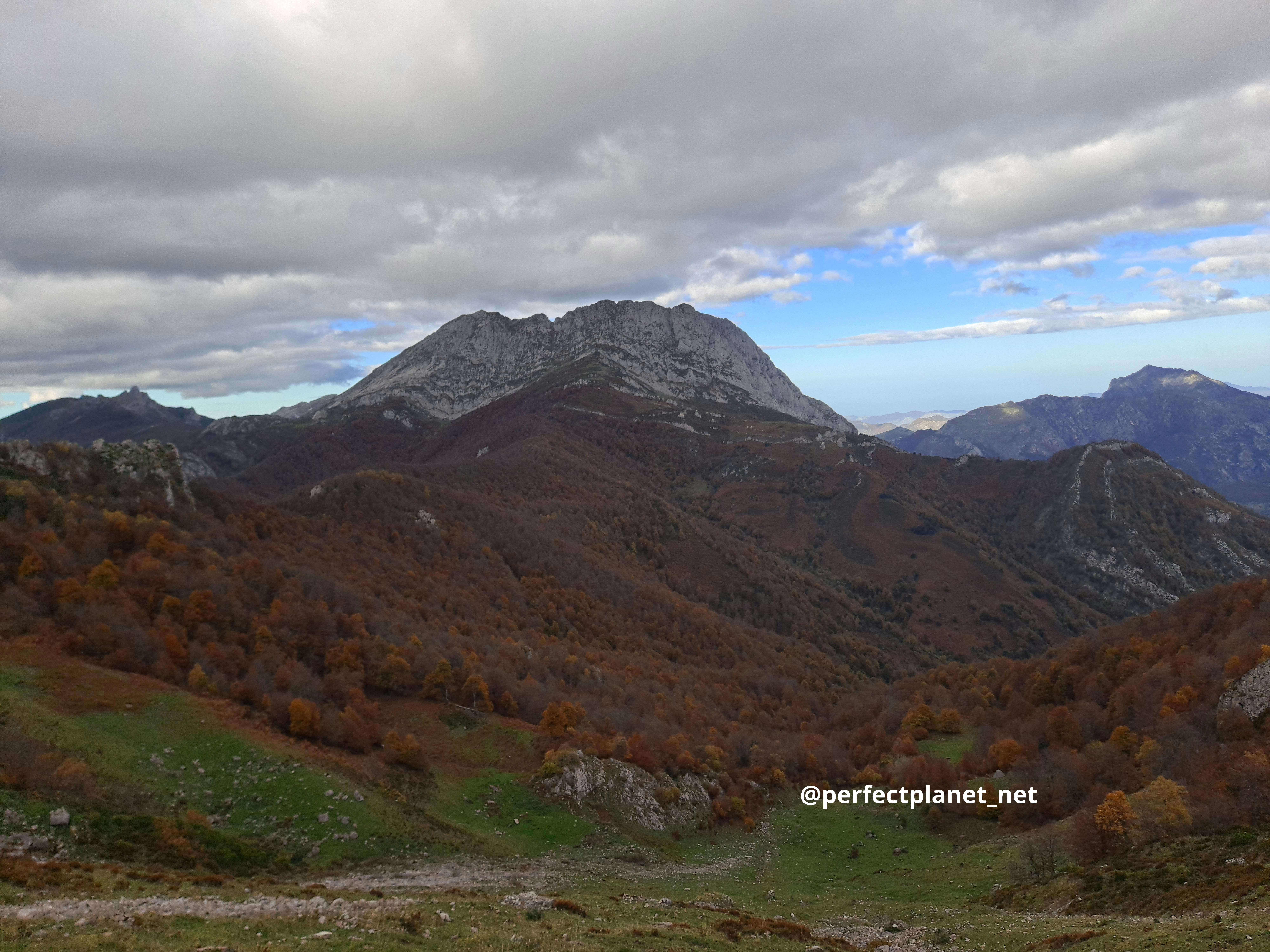
Ponga park views
Inside the beech forest the ascent begins to the Valloseru pass where we enter the Ponga Park. We have to descend a few metres without losing much height until we reach a hill from where we border the Maciéndome crag.
From Majada Maciéndome we start the ascent to the Llampas pass to take the path on the left and reach the summit. It is beautiful.
Ponga park views
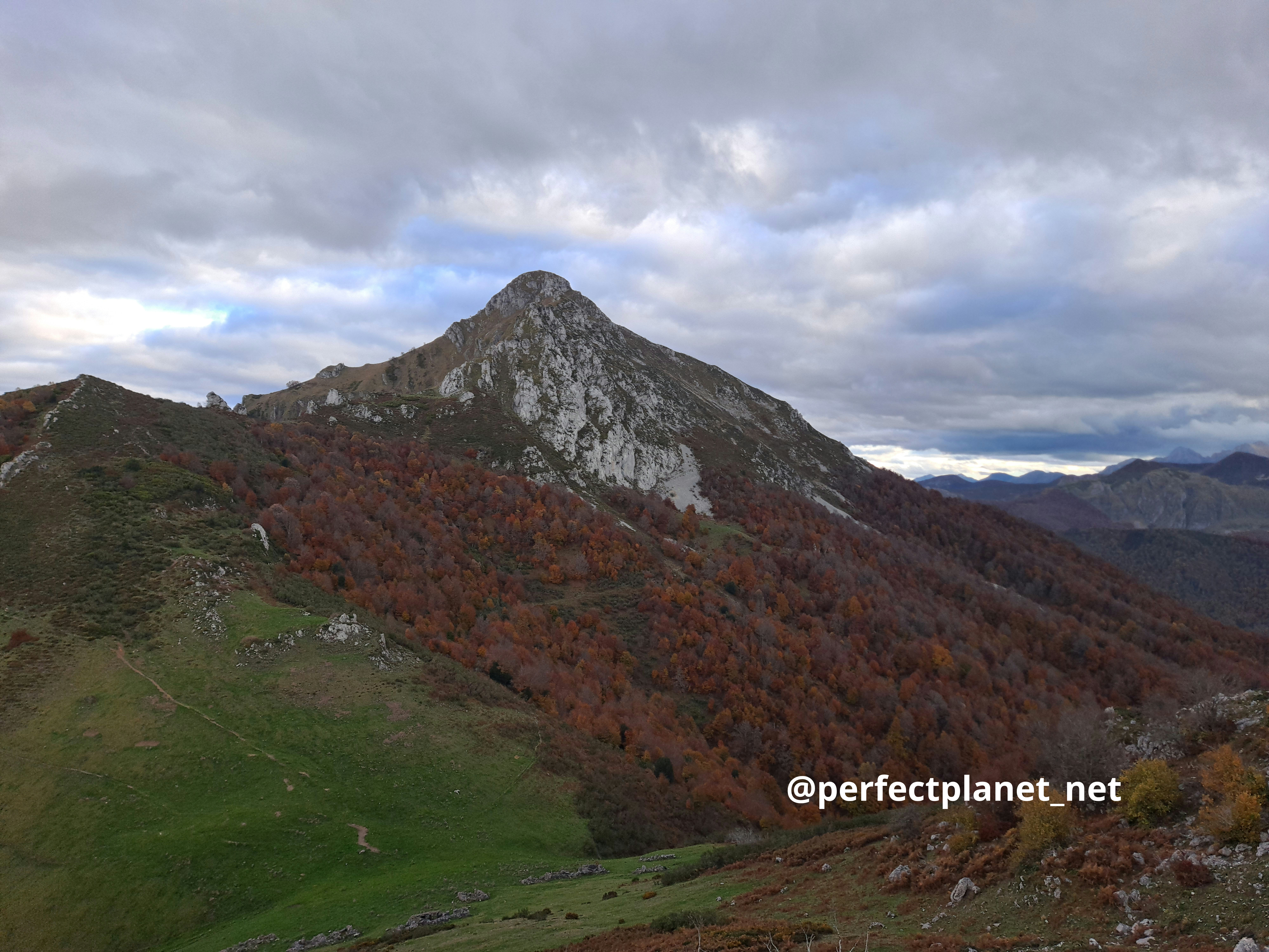
Maciendome
We descend along the south face towards the Llagu pass to climb the Cascayu peak which offers beautiful views of the Tiatordos.
From here the group divides, you can follow the route marked on the track along the Cuchiella to the track that takes you to Pendones or descend through the beech forest to the left of the Cascayu. We only recommend the latter option if you go with an expert in the Park like Manolo, as it is easy to get lost due to the density and unevenness of the forest.
Tiatordos
Distance 18 kilometres
Elevation gain 1,500 metres
Whoever uses and follows all or part of this track and its additional information, assumes full responsibility for the risks inherent in the practice of the activity, this information is for guidance purposes only.
Map
- Log in to post comments