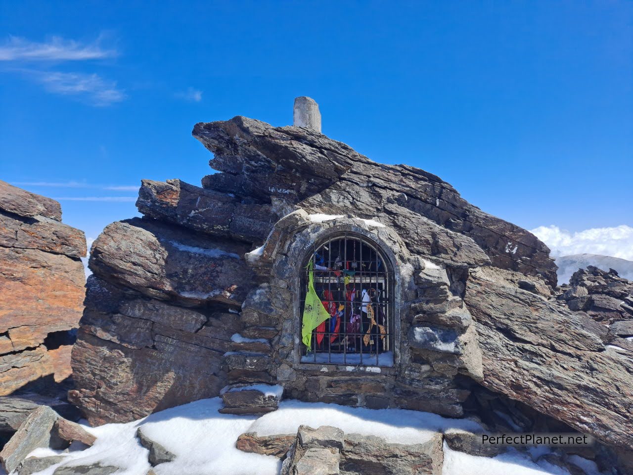
The Mulhacén peak, at 3,479 metres, is the highest peak on the Iberian Peninsula.
Mulhacen peak
Mulhacen peak
Located in the Sierra Nevada National Park in the province of Granada, the Mulhacén stands out among three thousand other neighbouring peaks such as the Alcazaba and Veleta peak.
Sierra Nevada and Veleta peak in the background
Poqueira refugee and Veleta peak in the background
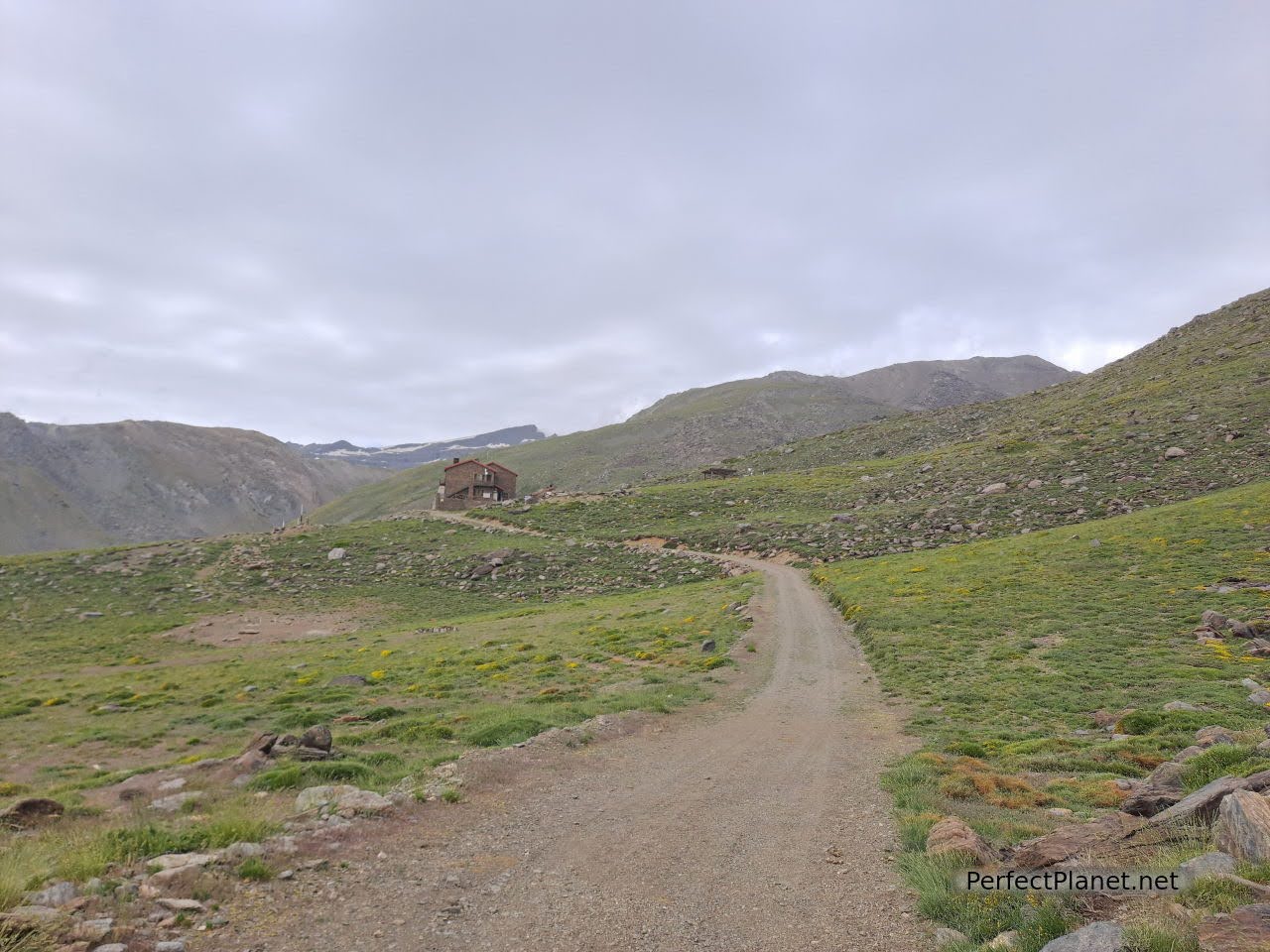
We start our route from the Granada village of Capileira in the Alpujarra to reach the Refugio de Poqueira where we will stay. Options to get to the refuge:
1. Shuttle bus from Capileira to Alto del Chorrillo and from here walk to the refuge 3.5 kilometres (13€ return trip per person, book in advance SIACSUR Interpretation service of High Peaks and Sierra Nevada National Park).
2. Leave the car at Hoya del Portillo and walk the remaining eight kilometres to the refuge (+- 600 metres difference in altitude). You walk up a track at the end of the village, which is in good condition.
3. Walk up from Capileira or Trevélez (+-1,200 metres difference in altitude), about 13 kilometres.
Poqueira Refuge
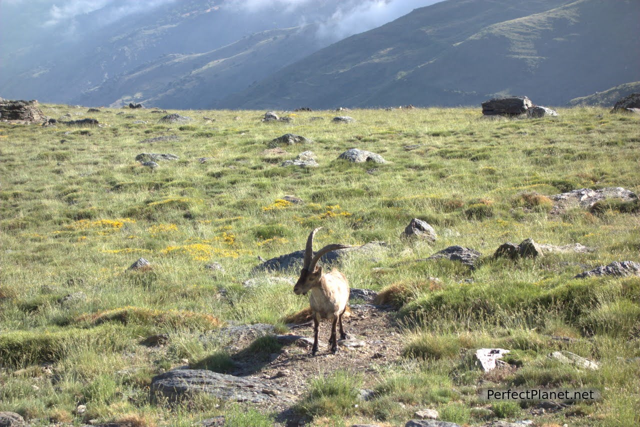
Once at the refuge (remember to book and read the regulations beforehand), we leave our backpacks and enjoy the views. The Veleta peak can be seen perfectly. The wild goats are bold and come very close until the owners' dogs scare them away.
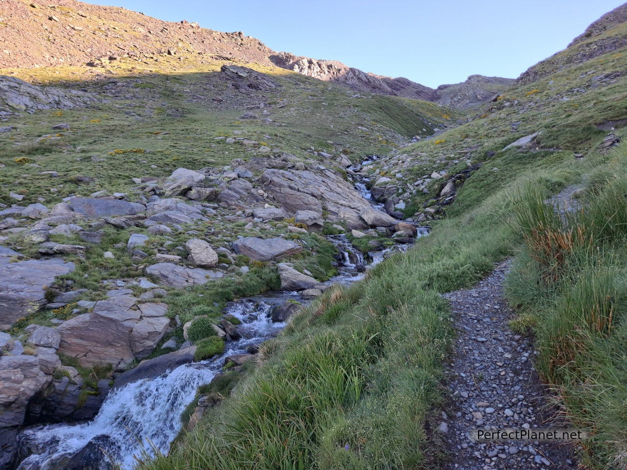
Going up the Mulhacén River
Going up the Mulhacén River
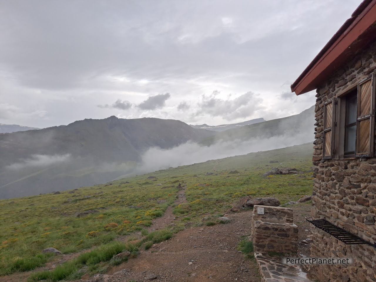
Due to covid regulations the refuge is at one third of its capacity. It is compulsory to wear a mask, sleeping bag and sheet (you can rent one for €2.5). There is no drinking water although there is a fountain at the entrance. We booked accommodation, breakfast and dinner, which by the way are brutal. If you're just passing through you have options for lunch or a drink.
Going up the Mulhacén River
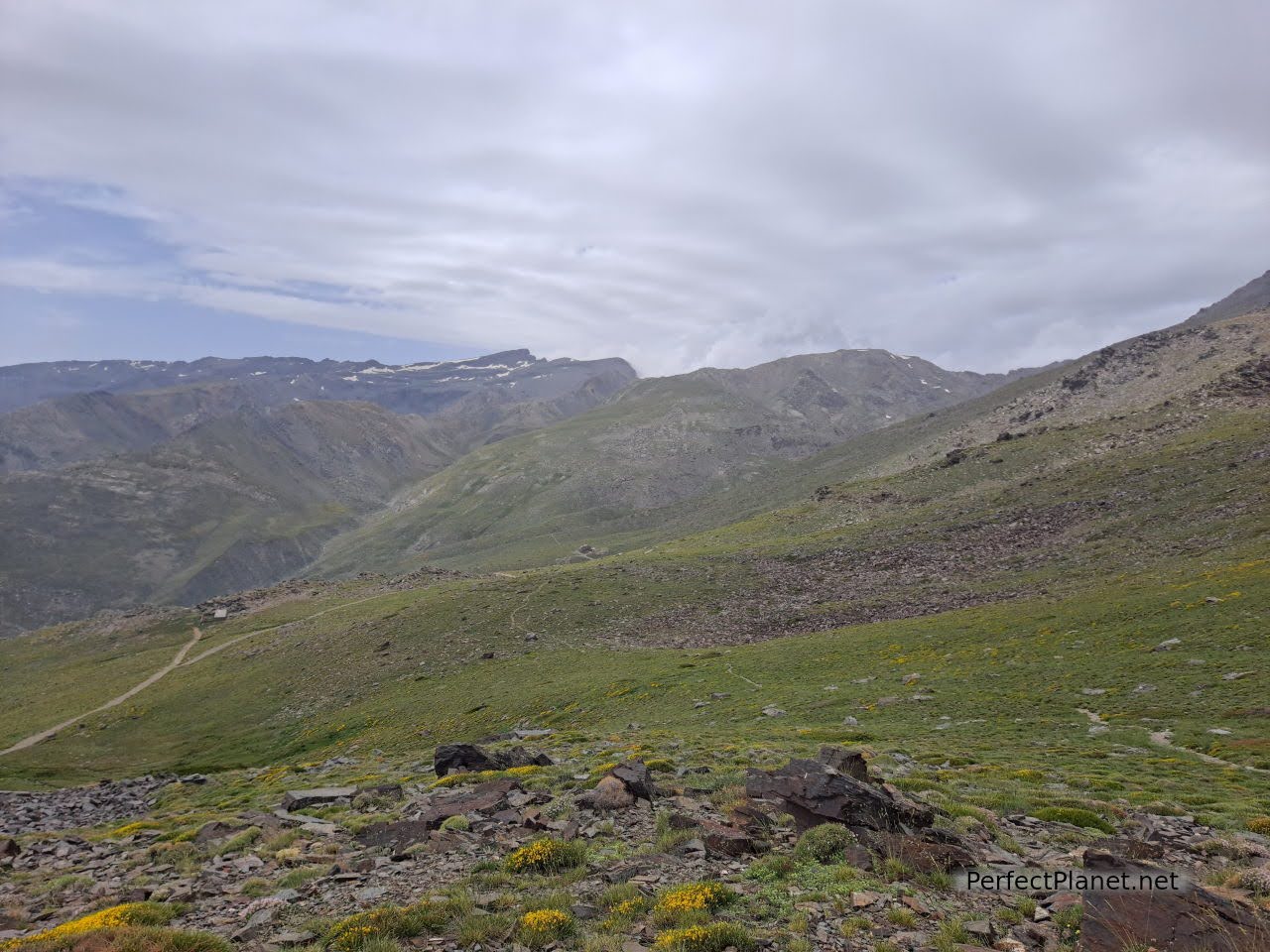
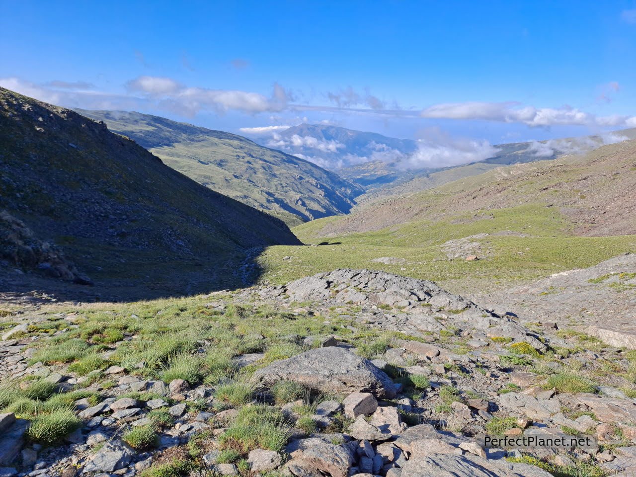
The route from the Poqueira refuge to the Mulhacén peak is about ten kilometres with 1,000 metres of ascent (6 hours) (we extended it a little more).
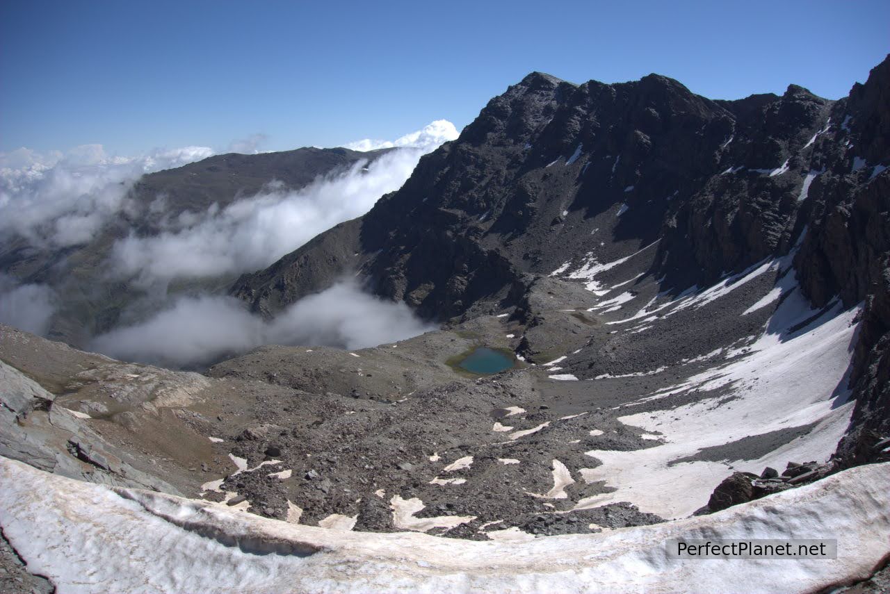
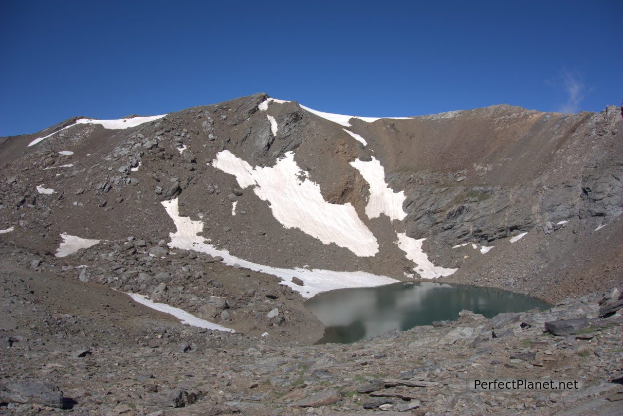
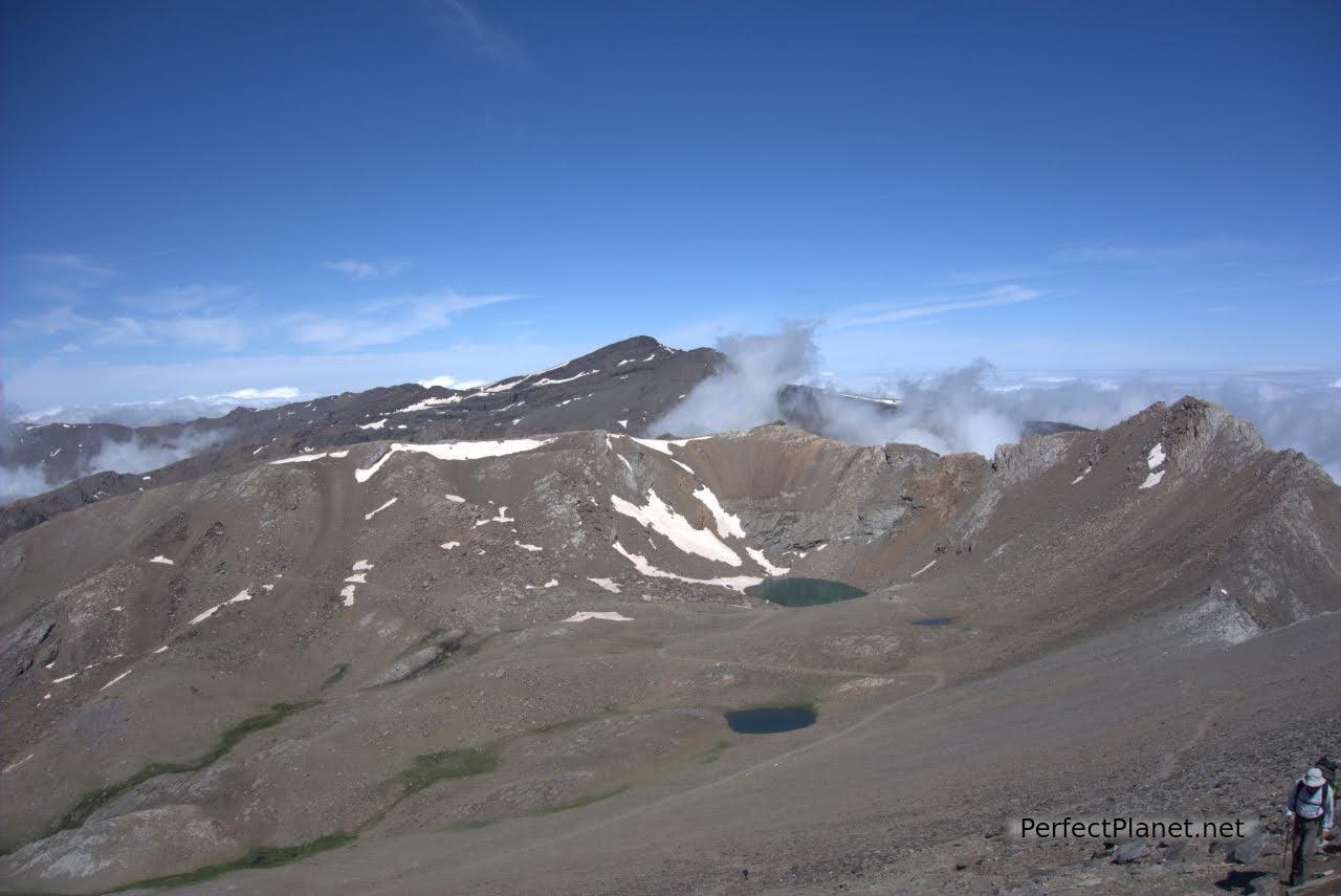
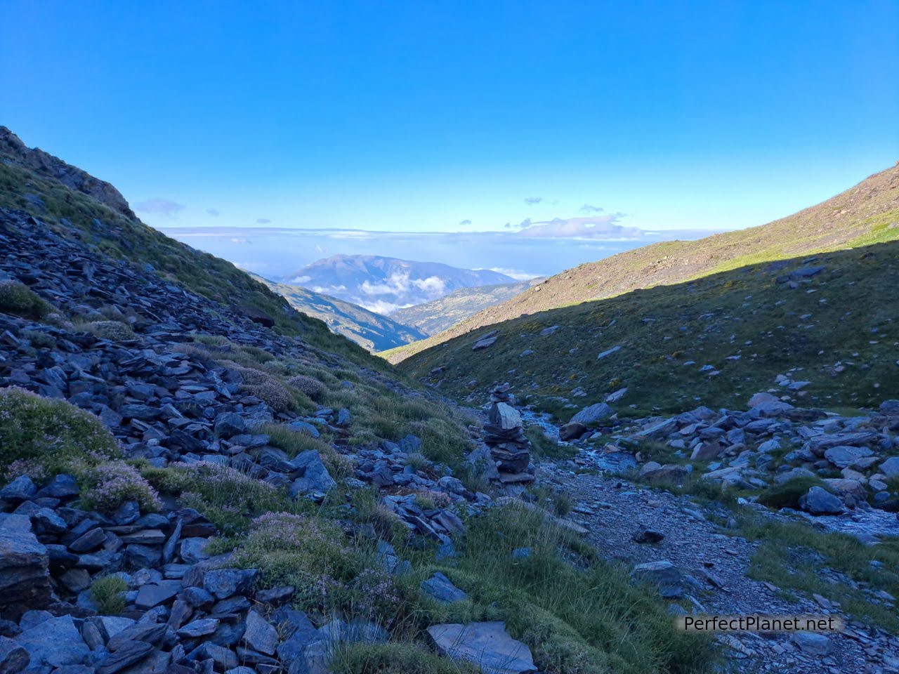
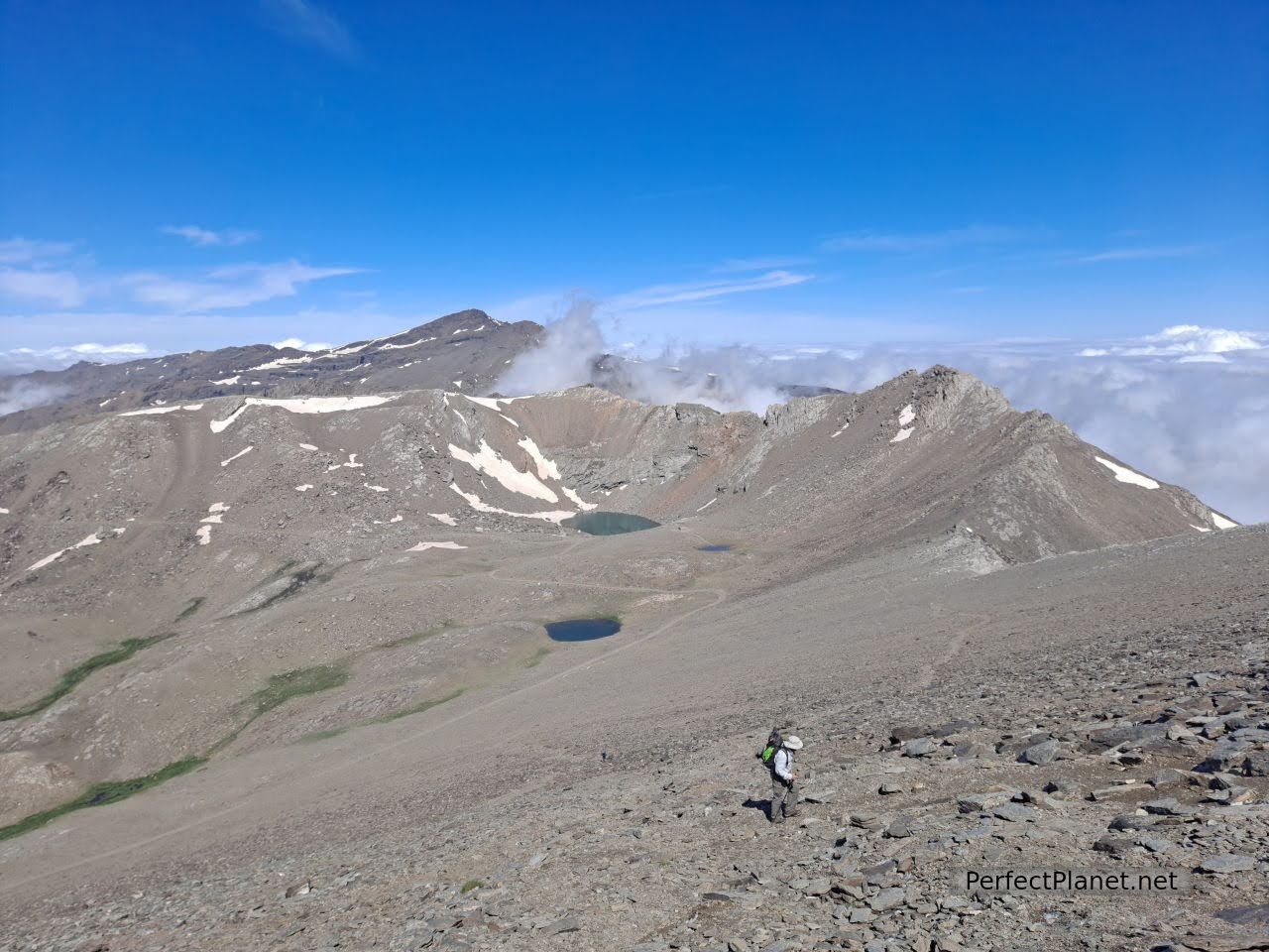
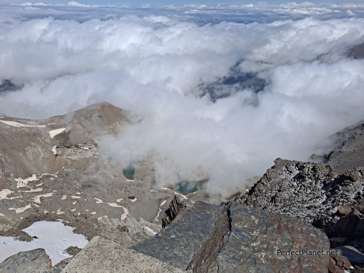
We start by going up the Mulhacén river to the Caldera bivouac hut with its beautiful lake and exceptional views of the Mulhacén peak and the Loma Pelá pass.
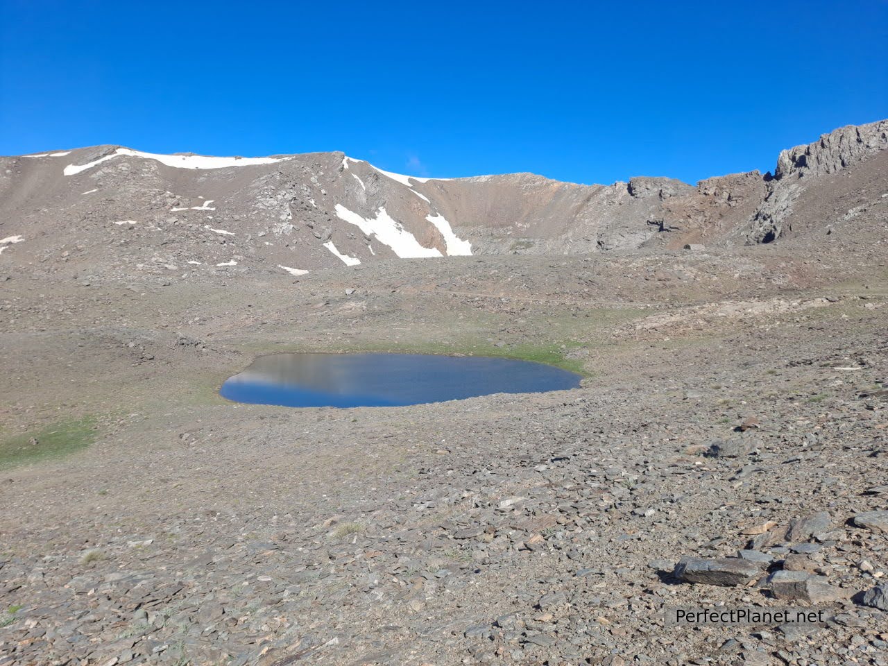
Majano lagoon
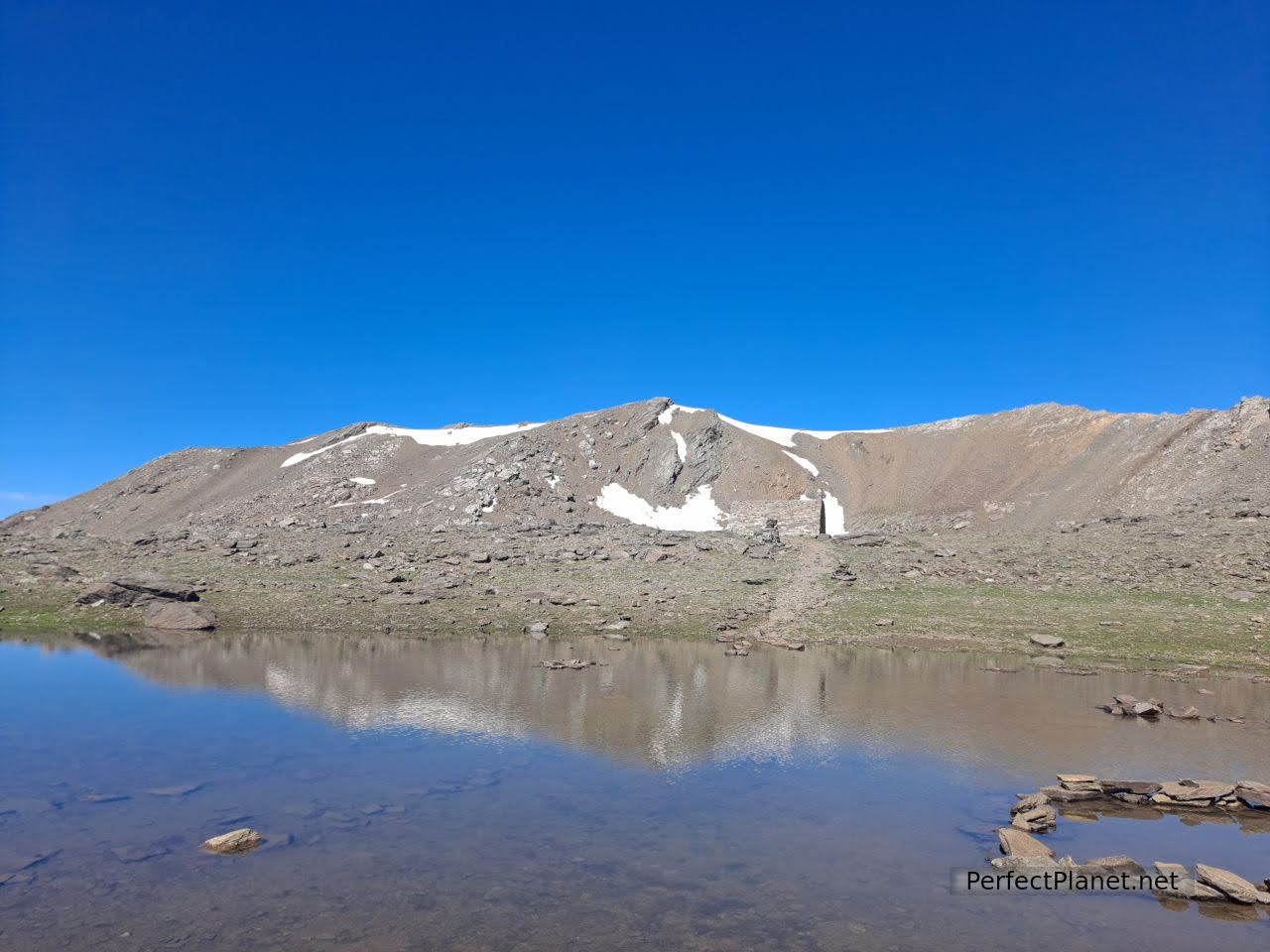
Caldera lagoon
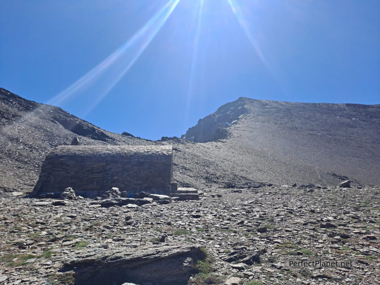
Caldera bivouac hut
The Caldera bivouac hut is very well equipped and clean, although it is small.
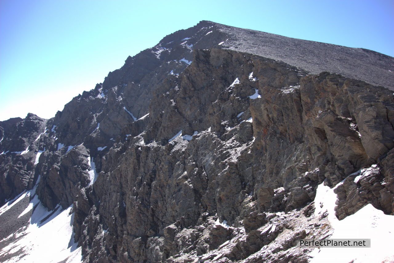
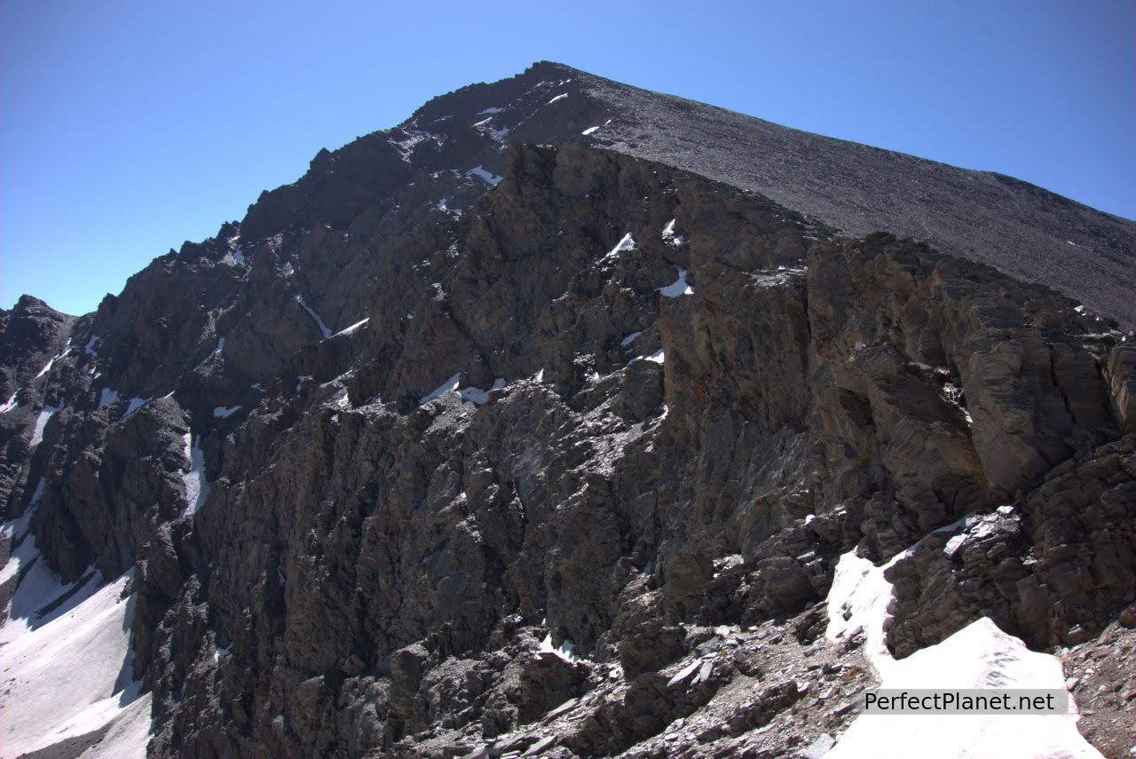
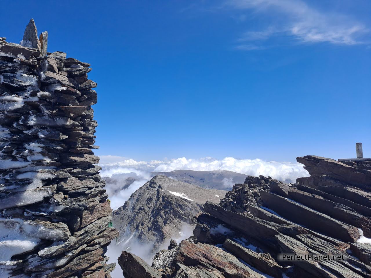
We continue to the Ciervo pass from where we have the privilege of contemplating the north face of the Mulhacén peak, the vasares and the Mosca lagoon.
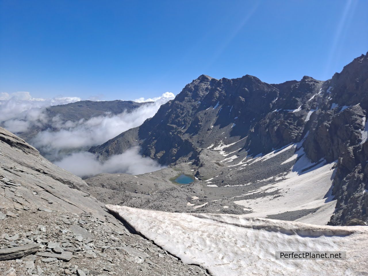
North face of Mulhacen and Mosca lagoon from Collado del Ciervo
North face of Mulhacen
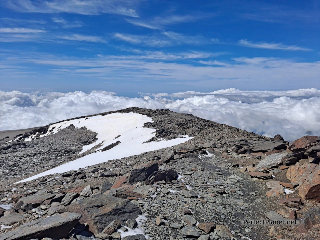
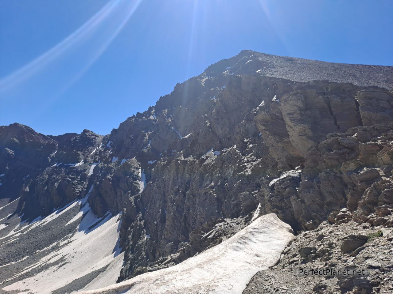
From here we make one last effort to reach the summit. We zigzag along the west face. This is the area with the steepest slope. The wind is blowing quite hard.
Climbing
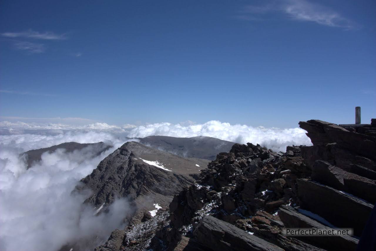
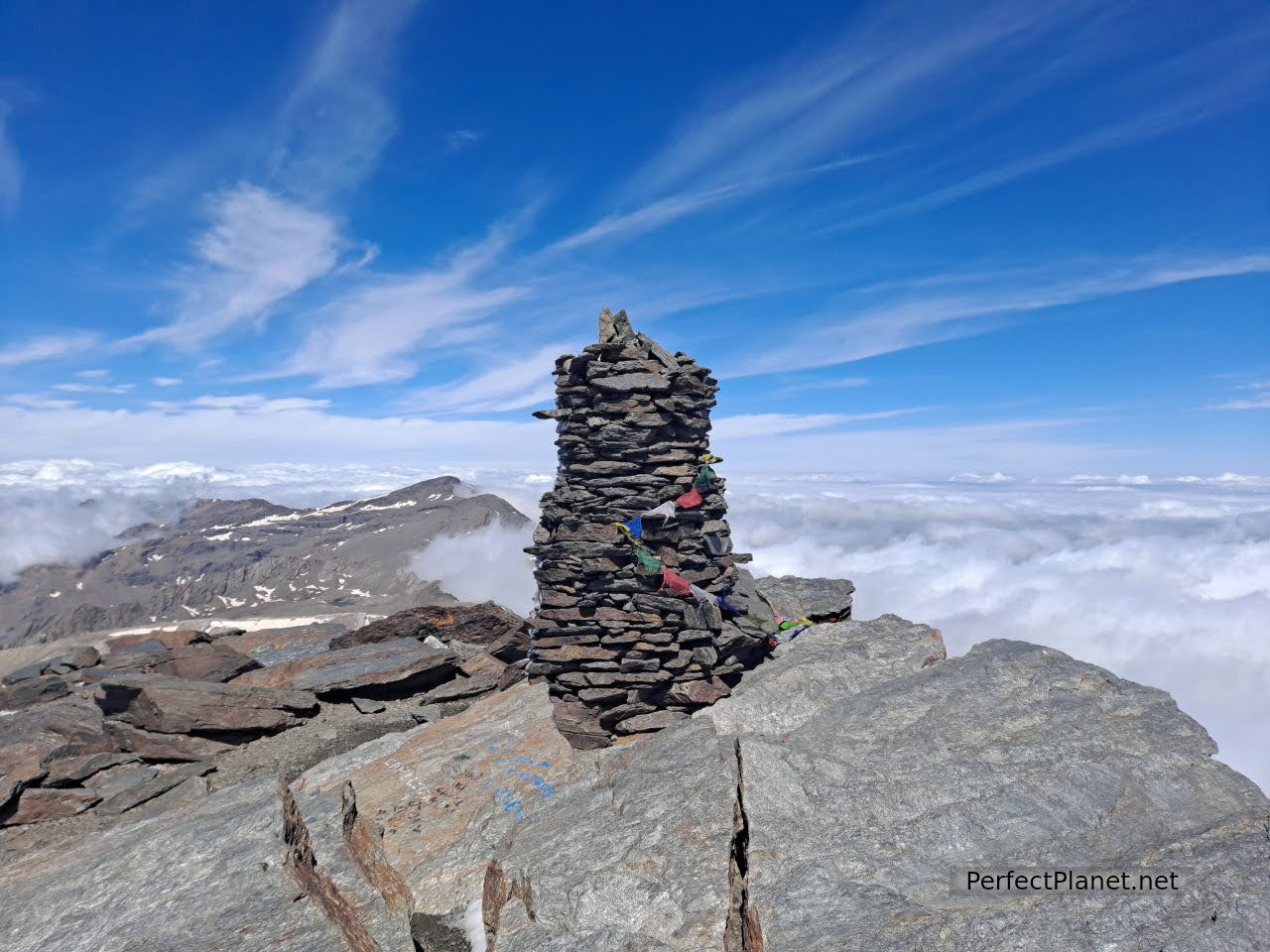
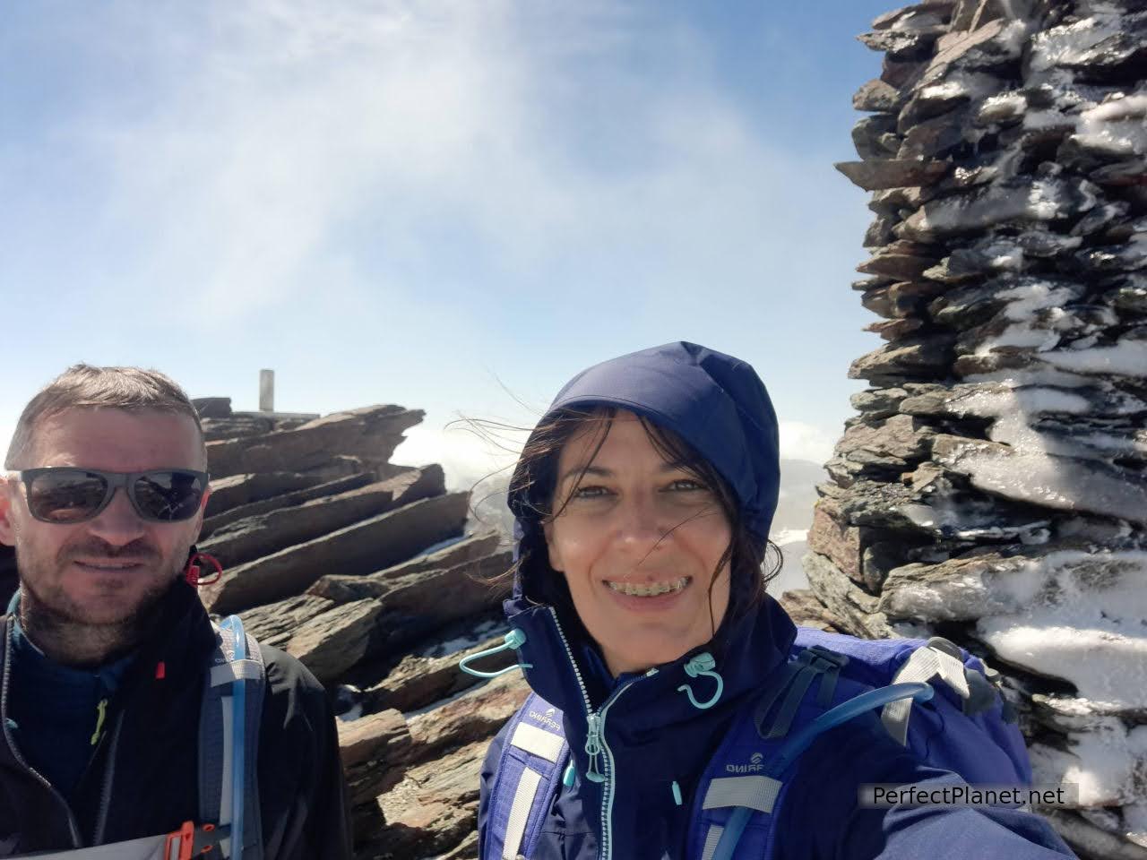
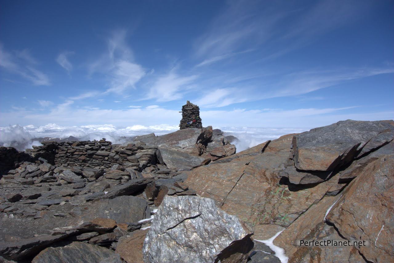
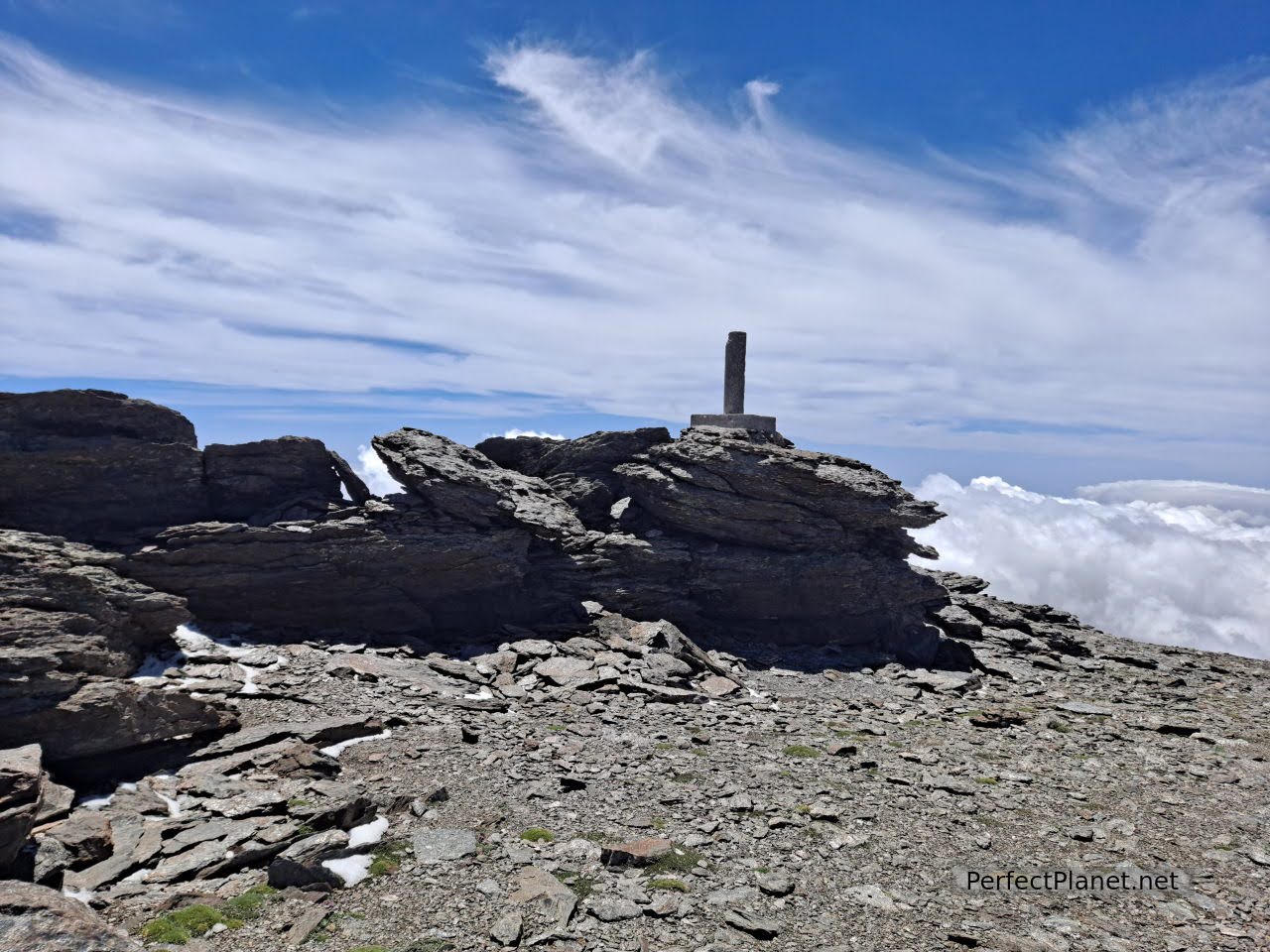
Once at the top the views leave us speechless. We are on the roof of the Peninsula and it couldn't be more beautiful. You have views of the Veleta peak, Alcazaba, Juego de Bolos, Peñón del Globo... It's time to enjoy.
Mulhacen peak
Mulhacen peak
Mulhacen peak
You can continue along the vassars of Mulhacén descending the east face towards the Siete Lagunas pass and climb the Alcazaba peak, although this is not very advisable as the vassars are cut and despite it being June there is a lot of snow between them. It is better to descend the south face and then head east.
The vassars of Mulhacén and Alcazaba peak
Mulhacen peak
In our case, we descend the south face towards the Mulhacén II peak (3,363 metres). It is the gentler side with a very steep slope, so if you are not in good shape we also recommend that you climb the south face.
Mulhacen II
If you want to extend the day you can visit the trenches and machine gun nest located near the Alto del Chorrillo. During the Spanish Civil War this area was the scene of several clashes between the two sides and was divided in two by the front line for most of the time the war lasted.
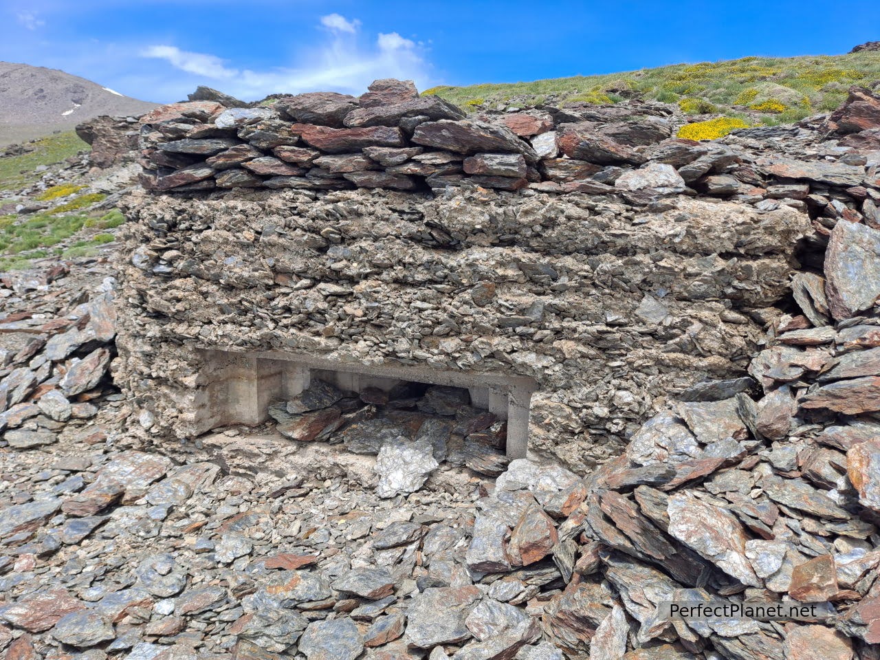
Machine gun nest
Remember:
Before organising any mountain outing, apart from taking the right equipment, check the weather pages to see the weather, wind speed and snow conditions. We use AEMET and Meteoexploration, which give a fairly reliable forecast, although the latter only for the main peaks. If you don't have a GPS like Garmin, the Wikiloc app is very useful, where you can download, record and follow the tracks of the routes you are going to do.
It is not necessary to hire a guide to make the ascent, the path is well marked and there are so many people that the trail is very visible. However, if you wish to do so, contact the Poqueira refuge beforehand.
Equipment needed: crampons, ice axe and helmet depends of the conditions. You should also bring a headlamp, water, GPS, extra battery, sleeping bag, warm clothes, first aid kit and sun cream. It is advisable to bring a rope, but not essential. Many people climb with skis.
Other options from the refuge:
Poqueira refuge, Pico Mulhacén to Pico Alcazaba (8-9 hours). Beautiful route.
Poquiera refuge to Pico Veleta by dry river (8-9 hours).
Poqueira refuge to Collado de Siete Lagunas.
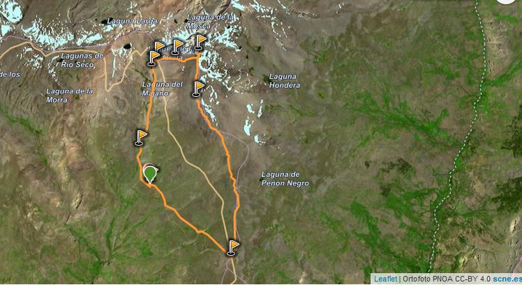
Map
Accommodation: Poqueira refuge, half board 34€/pax half board for members of the federation, including dinner and breakfast. For more information see the website.
Route: circular
Distance: 14 kilometres.
Difference in altitude: 1,000 metres
Tips: we start the route from Poqueira refuge going up to west face and going down to south face. Wikiloc track.
Difficulty: high, no technical difficulty.
Signposting: good.
Whoever uses and follows all or part of this track and its additional information, assumes full responsibility for the risks inherent to the practice of the activity, this information is for guidance purposes only.
- Log in to post comments